Showing posts with label Cut-Off Low. Show all posts

Saturday, 14 February 2015

#SAWeather and #Disaster #Observations South Africa : 14 February 2015 04h00 SAST - MSBWX


SAWS SEVERE WEATHER ALERTS: 
 
WARNINGS: -----Nil 

WATCHES: 1. A gale force south - westerly wind of 35kt wind is expected between Cape St. Francis and Kosi Bay. 2. Heavy rain of 50mm or more within 24 hours is expected in places over the North - eastern parts of KwaZulu - Natal , the lowveld and escarpment of Mpumalanga as well as the south - eastern parts of Limpopo Province overnight into Sunday.

SPECIAL WEATHER ADVISORIES: 1. Extremely hot temperatures are expected in places over the nor th - eastern parts of KwaZulu - Natal as well as the lowveld of Limpopo and Mpumalanga. 2. Extremely uncomfortable and humid conditions are expected over the north - eastern parts of KwaZulu - Natal as well as the lowveld of Limpopo and Mpumalanga.  

MSBWX National Severe Weather Observations:  Isolated thunderstorms were observed yesterday in areas of SA.  Buffelsjagriver experienced a "Mini" Cloud Burst, flooding parts of the N2. This was as a result of the cut-off low situated south of the country in the ocean.  Heavy rain and thunder were observed over the ocean yesterday afternoon in the Mossel Bay area.

MSBWX General Weather Observations:  Cool, warm to very hot conditions expected today over parts of SA. Thunderstorms and rain showers can be expected in parts of   Gauteng, Mpumalanga, Limpopo, North West, 
Free State, Eastern Cape and Kwazulu Natal.  Moderate to heavy rain showers expected in areas of the Western Cape.

MSBWX National Disaster Observations:  Thankfully the colder weather and rain dozed several fires in the Western Cape yesterday. However fire season is not over yet. Please be careful around open fires, throwing away cigarette butts and equipment that can start a fire. Be fire wise!

NSRI National Warnings and News: ------Nil

- MSBWX, SAWXREP + SAWS

Tuesday, 3 June 2014

Update 1: Cold Front: Western- , Southern-, Northern-, Eastern Cape and Kwazulu Natal 3 - 6 June 2014


Images: Eumetsat, NCEP, Weather Forecast and Snow Forecast (Click on images for larger view.)

Ok we now have a more detailed cold front approaching from the west which is expected to make landfall later this evening early tomorrow morning.  Pre-frontal rain has already fallen over parts of Cape Town tonight and further heavy rain (1 to 50mm) is expected in areas of the Western- and Northern Cape from tonight to Thursday with possible flooding in low lying areas. In the event of flooding do not try to cross flooded roads, rivers, bridges, ravines or ditches.  Do not drown rather turn around. The latest satellite image clearly reflect the front and very cold air behind the front which might result in snowfalls on the high mountains of the Western-, Northern-, Southern-, Eastern Cape and even KZN  as this cold air moves in behind the front. Experience has taught us to be very vigilant when snow falls on mountains of the Eastern Cape and Kwazulu Natal.  Last year and the year before last people had to be rescued that were trapped in mountain passes due to heavy snowfall.  If at all possible use alternative routes or postpone you trip until after the cold front has passed. If you have to travel take extra food, warm clothes and blankets with and monitor social media for weather updates.  Strong to Gale force NW (50 - 80km/h) wind  already occurred today in parts of the Western-, Northern-, and Southern Cape and is expected to continue as the front moves along. Be ware of fallen trees and do not use roads that are covered by trees as you never know when a tree will be uprooted by the wind. Very rough seas with waves between 4 to 9m can be expected along the South African coastline for the duration of the forecast period.  Do not venture into or onto the sea and postpone all sea and estuary activities.  Looking at the latest prediction charts there is the possibility for the development of a cut-off low system by Friday.  However it is still to early to say weather this will indeed materialize.

SAWXREP will continue to monitor the progress and effects of this weather system.  Updates will be available here or on our Twitter page at @SAWXREP or Facebook page by clicking HERE.

SAWXREP request real time weather observation reports from the public.  Tweet us at @SAWXREP or post on our Facebook timeline by clicking HERE.

Finally:  Please stay safe and if in doubt postpone outdoor activity and road trips to a later date.  Do not become another severe weather statistic.  To all our emergency services, disaster management personal and Search and Rescue personal take care and return safely whenever you receive the call for duty.

- MSBWX + SAWXREP

Saturday, 26 April 2014

George/Wilderness: Breaching of theTouw River

SOUTHERN CAPE NEWS - The Touw River was breached on Wednesday, the 23rd of April, at 2,18 meters to prevent flooding.

SANParks Senior Section Ranger for the Wilderness Section of the Garden Route National Park (GRNP), Nellie Grootendorst, says on Wednesday morning, a weather warning from the Eden District Municipality had predicted 50mm of rain for Tuesday and Wednesday.

‘On Wednesday morning, we noticed that rainfall was around the 50mm mark’ says Grootendorst. ‘This prompted our team of rangers to keep checking the measuring plate every 30 minutes.’

When it reached the 2 meter mark, at about 12:45pm, the water was pushed and ran over to sea. ‘If the water had failed to do this, SANParks was ready to use the bulldozer.’

Artificial breaching of the sandbars at the Touw River and Swartriver estuary mouths is done primarily to prevent flooding of neighbouring properties along the River. The open/ closed conditions of the estuary are often cited as one of several environmental factors to influence the abundance of marine fish in estuaries.

The set standards for breaching are 2 meters above mean sea level (amsl) for Swartvlei and between 2,1 and 2,4 meters for the Touw River.

Boilerplate:
The Wilderness system is fed by 3 rivers, the Touw River, the Duiwe River and Langvlei Spruit.

Issued by : SANParks via The George Herald

Friday, 25 April 2014

Final Update and Summary: Cold Front/Cut-Off Low (21 - 24 April 2014): Severe Weather - Western Cape/Southern Cape/Eastern Cape - Heavy Rain and flooding.

Image: Eumetsat (Click on image for larger view.)

This event is now something of the past. (hopefully) Once again this event started with an insignificant cold front and upper trough moving in over the Western Cape.  No early official warnings or a write-up was issued by the designated authorities.  This insignificant event turned into a severe weather event killing two people and leaving a trail of destruction in it's wake that will run into millions if not billions of rands of damage.  I will summarize a few "destructive events" that were caused by this Cold Front/Cut-Off Low.  I will not go into detail as this blog contains most if not all of  the information.

1.  Event started to unfold on the 22 April 2014 with a drastic change in the weather. Possibility of the development of a cut-off low along the Eastern Cape Coast.
2.  The cold front brought light rain to areas of the Southern Cape on the 22/4/2014 while heavy downpours, thunderstorms and intense lightning have been reported along the coastal areas of the Eastern Cape.
3.  A teenager was killed by lightning in Emandlutsha village in the Sholora administrative area in Elliotdale on the 22 April 2014 during a thunderstorm around 3pm.
4.  Hundreds of residents around Dutywa and Elliotdale had to scramble for shelter from the heavy downpours driven by gale force winds on Tuesday (22 April 2014) afternoon.
5.  In the disaster-prone Mbhashe local municipality a house was destroyed by fire and at least 30 cars were damaged in a trail of destruction left by a hailstorm. The storm, which struck around 3pm, destroyed windows in schools, government offices, cars and taxis.
6.  At the Govan Mbeki township near the Dutywa CBD, the corrugated iron roof of a row of four semidetached flats still under construction was blown off.
7.  In the Southern Cape heavy rainfall was observed at 02h00 on the 23/4/2014 and a flood observation report was issued at 02h10 as heavy rain continued to fall in the Mossel Bay area.
8.  42 mm of rain was recorded in Heiderand Mossel Bay up to 08h00 (23/4/2014) and it was still raining at that stage.   The total rainfall for Mossel Bay for this event is 70mm.
9.  Light to medium snowfall on the Drakensberg were reported by Snow Report SA and Afriski via Twitter on the 23/4/2014
10. 23/4/2014 - A fairly intense cut-off low system was developing along the Southern Cape coast. This was clearly visible on the latest satellite image.   We clearly had the "ingredients" for a cut-off low to dump heavy rain in areas of the Southern Cape and Eastern Cape.
11.   SAWXREP upgrade the Flood Expected Observation to a Flood Eminent Observation at 11h00 on the 23/4/2014
12.  Meanwhile it was still raining heavily in parts of the Southern Cape and Eastern Cape and flood levels were rising.
13.  Reports and images of heavy flooding in the East London area and localized flooding in the Port Elizabeth area were streaming in on Twitter and Facebook.
14.  Tragedy struck in East London when a five-year-old boy drowned while trying to cross a flooded pathway in Duncan Village on the 23/4/2014
15. Eden Disaster Management was on high alert following heavy rain in parts of the Southern Cape and possible flooding.
16. SAWXREP upgrade Flood Eminent Observation to a Flood Occurring Observation at 15h00 SAST  on the 23/4/2014
17.  Several road closures in Port Elizabeth and East London due to Flooding.
18.  Several vehicles stuck in water and several accidents reported in East London as a result flooding and rainy conditions.
19.  SAWXREP intruduced a new Flood Observation Code System. The following codes were created: FLOOD EXPECTED; FLOOD EMINENT; FLOOD OCCURRING and FLOOD LEVELS DECREASING. SAWXREP will use these codes to inform the public of rising water levels, flooding and flash flooding.
20.  Well over 100mm of rain were recorded in one day in areas of the Eastern Cape while 50mm and more in the Southern Cape.
21.  100's of people were left destitute after there homes were flooded.  Duncan Village in East London were the worst effected.  Disaster Management were busy making plans to accommodate destitude people in community centers. Localized flooding of houses, roads and sewerage systems.
22.  Rivers came down in flood while the Nahoon dam in East London were overflowing.
23.   There were a few new daily records (temperature and rainfall) set for the month of April. The Addo rainfall (57mm) is a 51 year record. Oudtshoorn reported a maximum of 13.2C, which is a 30 year record.  Mossel Bay rainfall (27.4mm) is a 5 year record. George (Witfontein) rainfall (47.4mm) a 6 year record.  More info available HERE.

There might even be more severe weather incidents but to date this is all that I have on record for the Western-,  Southern and Eastern Cape.  This "insignificant" weather system soon turned into severe weather  Looking at the events it is clear that this weather system was once again underestimated by many.

This event illustrated just how unpredictable cut-off low systems are and how destructive they can be.
Early warnings and press releases are crucial and once the "alarm" has been raised, we need to be prepared and ready for any eventuality.

The East London area should be declared a Disaster Area. Extensive damage were caused to property, infrastructure and roads.

Finally: I would like to thank all the members of public, private sector, radio amateurs, the media and real time observers who send photos, information and reports about this event. With the information received we kept the public informed. I am overwhelmed by the response.

Once again thank you for the support and service. I am looking forward to your continued support. With your help we can render a free service to the public and hopefully contribute to save and better the lives of those in need.

MSBWX would hereby like to express it's condolences and sympathy to all those families and friends who lost loved one's as a result of the severe weather this past few days.

Johan Terblanche
Founder: MSBWX, SAWXREP
Mossel Bay
25 April 2014

Tuesday, 22 April 2014

UPDATE 3: Cold front and upper trough to move in over the Western and Southern Cape Period: 21-24 April 2014

The current system brought light rain to areas of the Southern Cape while heavy downpours, thunderstorms and intense lightning have been reported along the coastal areas of the Eastern Cape.  It is still raining in parts of the Southern and Eastern Cape with heavy falls in the East London area moving towards the Wild Coast.  Further heavy falls are expected later this evening.  We need to keep an eye on the two areas encircled on the latest weather satellite image.
Image: Eumetsat (Click on image for larger view.)

The first circle South West of the country is another cold front moving towards the country.  This is not reflected on the latest synoptic chart but can clearly be seen on this satellite image. This front is expected to bring further rain to parts of the Western and Southern Cape.  Behind this front is very cold air and a sharp drop in temperature can be expected.  Keep an eye on this front!  The second circle reflect a heavy cloud base with heavy rain being dumped in the East London area and moving towards the Wild Coast Area.  It is still raining in parts of the Southern and Eastern Cape and further heavy falls are expected later this evening and tomorrow morning. 
Image: NCEP (Click on image for larger view.)

There is still a 30% chance of snowfall on the Southern Drakensberg mountains for the period 22 - 23 April 2014.  I have mentioned the development of a cut-off low system.  Well this is possibly still on the cards for tomorrow.  However the "cat and mouse" situation still continues and time well tell whether a cut-off low will indeed develop in the next 12 hours.   We still need to keep an eye on the weather as this system has shown how unpredictable the weather can be and how quickly it can change.

- MSBWX

UPDATE 2: Cold front and upper trough to move in over the Western and Southern Cape Period: 21-24 April 2014

Never a dull moment when you observe the weather.  Rapid changes in the past 12 hours.  Prediction models indicate that heavy rainfall of between 10 - 50mm can be expected today (evening) along parts of the Southern Cape coast while more that 50mm of rain is predicted for parts of the Eastern Cape by early Wednesday morning.  Forecast models indicate the Port Elizabeth can expect between 50 - 80 mm and East London between 40 - 60mm of rain the heaviest during Wednesday morning.  I am not that keen on weather predictions but rather prefer real time  weather observations.

NCEP GFS weekly total precipitation in mm


The above NAVGEM charts reflect the prediction of heavy rain. 

The latest weather satellite (SAT24) image this morning reflect a large cloud mass off-shore to the east of the country. This cloud mass is currently moving eastwards away from the land.


We however need to keep an eye on this cloud mass and the weather  for the next few days as there is still a possibility of the development of a cut-off low along the Eastern Cape Coast.  We therefor currently have a "cat and mouse" situation.  MSBWX will monitor this event as it should become clearer later today what we can really expect from this event.   Updates to follow.

Thursday, 27 March 2014
Summary: Heavy rain (possible severe weather) expected in parts of the Western- Southern- and Eastern Cape ( Period: 23 - 27 March 2014)

Image: Modis - NASA (Click on image for larger view.)

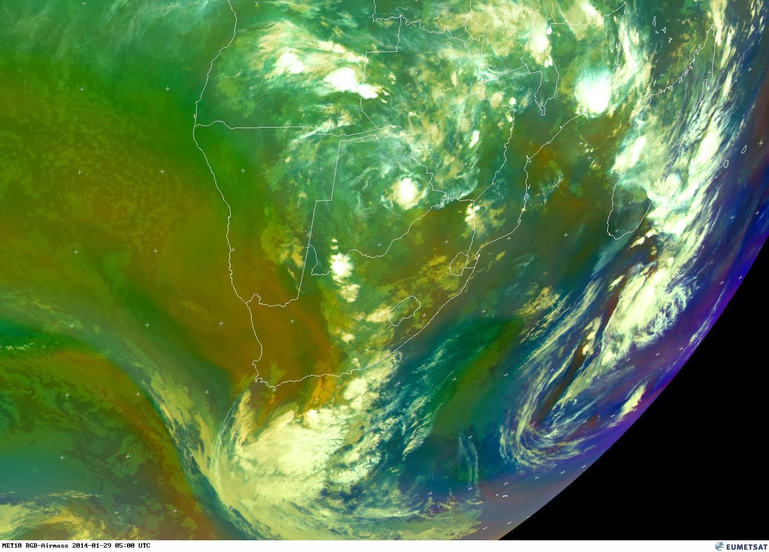
This event is now something of the past. (hopefully)  Thankfully it did not left a trail of destruction in it's wake.  I will summarize a few "interesting facts" regarding this cut-off low system. I will not go into detail as this blog contains most if not all of  the information.

1.  Cut-off low systems are complex, their outcome unpredictable and notorious for extreme precipitation. 2.  Few detailed studies of cut-off low events has been undertaken in the Southern Hemisphere. 
3.  The cut-off low this week did not result in extreme rainfall, flash flooding or infrastructure damage.
4.  The lack of a strong onshore low-level flow (black southeaster) and the lack of enough surface heat thankfully contributed to the moderation of this system. 
5.  I spoke about the lack of "ingredients" in one of my updates. Yes, we need to have all the "ingredients" for a cut-off low to result in severe weather. 
6.  Eden Disaster Management issued an advisory at 12h00 on the 25/3/2014 to the effect that the  public need to be aware of the fact that if it continue to rain in areas, flooding may occur in low lying areas. People living in areas prone to flooding should prepare for possible evacuation if the rain continue to fall.
7.  At 14h00 (25/3/2014) it stopped raining in the Mossel Bay area and the rain started to clear from the West. 
8.  This was one of the strangest cut-off lows I ever observed.
9.  26mm of rain was recorded in Heiderand, Mossel Bay.
10.  Rainfall of between 10 - 30mm were recorded in parts of the Western-  and Southern Cape. 

Even though warnings of heavy rain and flash flooding were issued and it did not materialize we should never underestimate cut-off low systems and their potential to cause disasters. Early warnings and press releases are crucial and once the "alarm" has been raised, we need to be prepared and ready for any eventuality. Examples of severe weather and destruction caused by cut-off lows: 1968 - Port Elizabeth; 1970 East London; 1981 Laingsburg; 1987 Kwazulu Natal; 2002 East London; 2003 Montagu; 2004 Southern Cape; 2005 Bredasdorp; 2006 Southern Cape; 2007 West Coast; 2007 Southern Cape; 2008 West Coast and 2008 Cape Winelands.

Finally: I would like to thank all the members of public, private sector, radio amateurs, the media and real time observers who send photos, information and reports about this event. With the information received we kept the public informed.

Once again thank you for the support and service. I am looking forward to your continued support. With your help we can render a free service to the public and hopefully contribute to save and better the lives of those in need.

Johan Terblanche
Founder: MSBWX, SAWDOS, SAWDIS
Mossel Bay
27 March 2014

Tuesday, 25 March 2014

UPDATE: Heavy rain (possible severe weather) expected in parts of the Western- Southern- and Eastern Cape ( Period: 23 - 27 March 2014)

14h45 SAST - Stopped raining in the Mossel Bay area. Looks like it is clearing from the West. Eastern Cape it is now your turn for some rain.


12h00 SAST -  Continues rain still falling in the Southern Cape and Eden Area with an increase in intensity of the system. The public need to be aware of the fact that if it continue to rain in these areas, flooding may occur in low lying areas. People living in areas prone to flooding should prepare for possible evacuation if the rain continue to fall.

Here is the latest satellite images:


 Images: SAT24, Eumetsat and Weather Underground (Click on images for larger view.)

UPDATE: Heavy rain (possible severe weather) expected in parts of the Western- Southern- and Eastern Cape ( Period: 23 - 27 March 2014)

Update: 09h00 SAST:  Definite increase in rainfall in the last hour in Mossel Bay.


Latest satellite images: Continues light rainfall throughout the night in Mossel Bay.  I expect an increase in rainfall for the Southern Cape area in the next hour.


Latest Rainfall Prediction chart: 

Images: NCEP, SAT24 and Wunderground  (Click on image for larger view.)

Monday, 24 March 2014

UPDATE: Heavy rain (possible severe weather) expected in parts of the Western- Southern- and Eastern Cape ( Period: 23 - 27 March 2014)

Image: Eumetsat (Click on the image for larger view.)

This is one of the strangest cut-off lows I ever observed.  Just goes to show how strange and unpredictable cut-off lows really can be. We experienced a heavy downpour in the past half and hour in Mossel Bay but then it  suddenly stopped. It was a very humid day in Mossel Bay today with upper air mist moving in from the South East.  It later cleared in the day only to move in this evening again.  This normally happens in Mossel Bay when a cut-off low is situated to the west of the country.  Lacking however is a good old South Easterly wind to really help things along.    The system is currently dwindling west of the country and we need to still keep an eye on the weather. Plenty of moisture still in the air. The latest prediction charts again reflect moderate to heavy rain  in parts of the Northern- , Western-, Southern- and Eastern Cape.


Images: NCEP (Click on images for larger view.)

Sunday, 23 March 2014

UPDATE: Heavy rain (possible severe weather) expected in parts of the Western- Southern- and Eastern Cape ( Period: 23 - 27 March 2014)

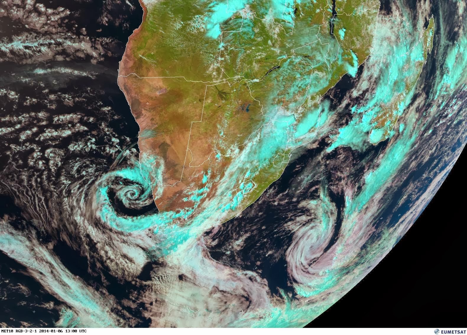
The latest weather satellite image clearly reflect the cut-off low pressure system to the west of the country while the upper trough is embedded over the Northern Cape and Western Cape.  Compare the latest satellite image to this morning's image and you will notice that the system is clearly developing in structure while the table is set for the possible further development of the cut-off low. 


Images: Eumetsat  (Click on images for larger view.)

The latest predictions charts have also changed since this morning.  These charts now reflect the possibility of moderate to heavy rain in areas of the Western Cape, Northern Cape, Southern Cape and Eastern Cape.
Quite a significant change since this morning's charts.


 Images: NCEP (Click on images for larger view.)

I would however like to reiterate that the amount of rain in a specific area as a result of a  cut-off low is difficult to predict. When an upper-level  low-pressure system becomes "stuck" in one place due to a lack of steering currents, it is known as being "cut off". The usual pattern which leads to this is the jet stream retreating, leaving the then cut-off system behind.

What can we possibly expect in the next few days?  (Please note weather is not an exact science.  I prefer real time weather observations rather than to rely on prediction charts.)  However here is my personal outlook for the above period.

1.   Moderate to heavy rain.
2.   Possibility of thunderstorms
3.   Strong to gale force winds (23 - 65 km/h)
4.   Flash Flooding
5.   Rough Seas
6.   Bad visibility
7.   Flooding


It is still to early to say for certain if the system will result in severe weather, however at this stage it appears that this is a significant system that should be observed full time as from today and throughout the rest of the week.

MSBWX  hereby ask the general public to forward any reports of severe weather conditions and flash flooding to the MSBWX. Use your cellphone, digital camera, email and private weather station etc. in gathering and forwarding information, photos and data to MSBWX.  Email observations to MSBWX by clicking HERE.

We also remind our readers that MSBWX also utilize Twitter to keep our readers informed.

https://twitter.com/MosselBayWX2013 

MSBWX request that members of the public be on high alert during the above period!! 

- MSBWX

Wednesday, 29 January 2014

Update 3: Medium to heavy rain forecast for parts of the Southern Cape Area (28 - 30 January 2014)

12mm of rain was measured in Heiderand,  Mossel Bay.  This rain fell in the early hours of the morning and brought some relief to the hot weather we experienced the past few days.  This morning satellite image reflect that the upper air trough moved eastwards and is now situated over the Eastern Cape,  Free State and North West.  A large bank of clouds is also situated offshore to the south of the country but it would appear at this stage that this bank of clouds is moving eastwards away from the main land.


The latest prediction charts indicate that there is a possibility of light rain in parts of the drought stricken area of the Northwest Province.  Let's hope that this area of the country receive much needed widespread rain in the next few days.


I am still keeping an eye on the current system.  Although no cut-off low developed one should keep and eye on the weather as such systems in the past showed that mother nature and especially the weather has a will of its own.

- MSBWX

Tuesday, 28 January 2014

Update 2: Meduim to heavy rain forecast for parts of the Southern Cape Area (28 - 30 January 2014)

The weather changed rapidly in the last few hours. It started to rain steadily at around 20h15 SAST in Heiderand, Mossel Bay. The latest satellite images reflect the upper air trough clearly which is now situated over parts of the Western and Northern Cape.  We need to keep a close watch on the current further development of the system.  It would appear that this system might develop into a cut-off low.  This is not clearly defined at the moment but should become clearer as and if the system develop further.  Quiet noticeably is the fact that this system looks the same in structure as the systems that brought heavy rain and flooding in November 2007 and 2008 to the Southern Cape and Overberg areas.  The difference is the lack of sufficient moisture at this stage.  That goes without saying that this could change if a cut-off low develops. 


Images: SAT24 + Wunderground (Click on images for larger view.)

Sunday, 26 January 2014

Meduim to heavy rain forecast for parts of the Southern Cape Area (28 - 30 January 2014)


Current forecast models indicate the possibility of medium to heavy rain for parts of the Southern Cape from the 28 - 30 January 2014. An upper trough is expected to move in over the Southern Cape accompanied by tropical moist air from Namibia.  There is thus the possibility of instability which could result in thunderstorms in parts of the Western- , Southern Cape and Karoo.  

PLEASE NOTE:  It is early predictions and conditions can still change in the next 72 hours.. We need to keep an eye on the development of this system in the next few days!

Images: NCEP + NOAA


Friday, 17 January 2014

Mosselbaai: Trokbestuurder ontvlug vloedwaters

'n Mosselbaaise vragmotorbestuurder moes vlug vir die vloedwater deur Meiringspoort verlede week. Hier is 'n foto wat hy geneem het van sy vragmotor, geparkeer agter 'n ander, tydens die insident Beeldmateriaal hiervan is ook op SABC-nuus uitgesaai op 9 Januarie. Foto: Verskaf 

MOSSELBAAI NUUS - 'n Plaaslike vragmotorbestuurder het 'n noue ontkoming gehad toe sy voertuig tydens onlangse oorstromings in Meiringspoort deur vloedwater meegesleur is.

Die vragmotorbestuurder, wat verkies om anoniem te bly, bestuur al meer as 20 jaar lank swaar voertuie en is ongeveer die afgelope 18 maande in diens van Unitrans, gemoeid met die vervoer van brandstof.

Op Woensdag, 8 Januarie, onderweg terug vanaf Beaufort-Wes na Mosselbaai nadat die vrag reeds afgelaai was, is die voertuig om ongeveer 18:00 duskant Klaarstroom net voor Meiringspoort deur die SAPD gestop, omdat die pad vir vloedgevaar gesluit was.

Beeldmateriaal van die insident is op 9 Januarie op SABC-nuus uitgesaai, waartydens die stilstaande vragmotor en dreigende vloedwater duidelik sigbaar is. Volgens berigte, is minstens 14 mense uit Meiringspoort gered tussen Klaarstroom en De Rust nadat hulle deur vloedwater vasgekeer is.

"Drie vragmotors en verskeie motorvoertuie is gestop. Ek het etlike ure in my vragmotor gewag vir verdere nuus oor die stand van die vloedwater," vertel die bestuurder.

Teen ongeveer 23:00 het die watervlak egter so vinnig gestyg dat die vragmotor nie vinnig genoeg na veiligheid geskuif kon word nie. "Ek moes letterlik ongeveer 'n 1km padlangs weghardloop om nie self deur die vloedwater verswelg te word nie."
Hy het skuiling gevind by die SAPD-kantoor op Klaarstroom en die res van die nag daar deurgebring.

"Toe ons die volgende oggend gaan kyk, het my vragmotor ongeveer 200m van waar ek dit gelos het, gespoel. Boonop het die krag van die vloedwater die vragmotor gedraai sodat die voertuig se neus in die teenoorgestelde rigting gewys het as waarheen ek op pad was terug Mosselbaai toe."

Hy vertel dat die vragmotor se ligte vol gras en opdrifsels gespoel het en die stuurkajuit was vol grond en klippe.

"Ek kon darem by die kajuit uitkom om my paar persoonlike items te verwyder. Ek dink egter ek ly nou nog aan skok na die petalje."

Hy meen dat die vragmotor erg beskadig is tydens die insident. Die omvang van die skade is egter nog nie bevestig deur Unitrans se kantoor in Kaapstad nie.

- Mossel Bay Advertiser

Tuesday, 14 January 2014

Facebook photos 'go big'!

The aerial photo of Meiringspoort.

The Calitzdorp 'tornado' photo.

SOUTHERN CAPE NEWS - The power of social media became evident once again when 2 photos on Facebook were viewed and shared by tens of thousands of users over the past few days.

The first photo, an aerial photo of the flooding in Meiringspoort on the Oudtshoorn Courant Facebook page, was viewed over an astonishing 27 600 times. The photo was also shared by over 476 users.

On the George Herald Facebook page, the same photo was viewed over 29 500 times and shared by over 522 users.

A dramatic photo of a tornado (funnel cloud) near Calitzdorp was viewed over 12 600 times on the George Herald facebook page, and over 11 700 times on the Oudtshoorn Courant's page. The photo was shared by over 500 users.


- George Herald

Saturday, 11 January 2014

Meiringspoort-oorstromings 14:33 (GMT+2), Fri, 10 January 2014

Foto: Oudtshoorn Courant-redakteur, Hannes Visser, op een van die laagwaterbruggies. 

OUDTSHOORN NUUS - Meiringspoort is steeds dig gesluit vir verkeer.

Die Oudtshoorn Courant het vanoggend met behulp van die mense van Magic Moppers, wat verantwoordlelik is vir die instandhouding van die poort se fasiliteite, deur die poort gery.

Die padoppervlak is op plekke heeltemal weggespoel en die skouers van die pad is op plekke ook heeltemal uitgekalwe. Reuse klippe, stompe en hope grond en klip lê by elke drif en was vanoggend slegs met 4x4 voertuie toeganklik.

JR Towing was vanoggend met behulp van ‘n groot insleepvoertuig van die Weermag besig om ses voertuie wat Woensdagnag deur die vloedwaters oorspoel is te verwyder.

Volgens kenners wat in die poort was, is die kanse uiters skraal dat die poort die naweek oop sal wees. Al die rusplekke is beskadig en daar is geen water by die ablusiegeriewe nie aangesien die pyp ook weggespoel het.

Mense wat tussen Beaufort-Wes en Oudtshoorn reis word gevra om die roete via Aberdeen en Willowmore te gebruik.

Vanoggend het dit nog hard in die poort gereën maar aan Klaarstroom se kant het dit teen 09:00 nie meër gereen nie. “Dit beteken egter nie dat die reën opgeklaar het en dat die rivier nie weer kan afkom nie,” het ‘n lid van die nooddienste vanoggend gewaarsku.

Die Oudtshoorn Courant het vanoggend met behulp van die mense van Magic Moppers, wat verantwoordlelik is vir die instandhouding van die poort se fasiliteite, deur die poort gery. 

Die padoppervlak is op plekke heeltemal weggespoel en die skouers van die pad is op plekke ook heeltemal uitgekalwe.

ARTIKEL EN FOTO'S: HANNES VISSER, OUDTSHOORN COURANT-REDAKTEUR

Friday, 10 January 2014

Final Update: Cold Front/Cut-Off Low (4 - 9 January 2014): Severe Weather - Western Cape/Southern Cape/Karoo - Heavy Rain and flooding.


Images: Eumetsat + Aqua Modis - NASA (Click on images for larger view.)

This event is now something of the past. (hopefully)  However it left a trail of destruction in it's wake that will run into millions if not billions of rand of damage.  I will summarize a few "destructive events" that were caused by this Cold Front/Cut-Off Low.  I will not go into detail as this blog contains most if not all of  the information.

1.  Several yachts participating in the Cape Town to Rio Yacht Race had to be rescued after they ran into this severe weather system.  One person dead and several others injured.
2.   2 people killed after being washed away by floodwater in the Robertson area.
3.   Officials are searching for the body of a mentally handicapped man swept away by flood water in the Langeberg district.
4.   N1 closed to traffic at Laingsburg due to flooding of the access bridge into the town. Floriskraal dam near Laingsburg 176% full. People evacuated that lives near the dam wall as precautionary measure.
5.   People were caught in rushing rivers, streams overflowed and roads were blocked off by scattered debris as parts of the Western Cape were inundated with up to 110mm of torrential rainfall.
6. Several people were successfully rescued from flood water by Western Cape Emergency Medical- and other services.
7. Residents of the Buffelsjagsrivier informal settlement and the Bontebok National Park in Swellendam were evacuated on Monday evening as a precautionary measure.
8.   Several national and secondary roads flooded and closed to traffic.
9.   Localized flooding of houses, roads and sewerage systems - several Western Cape towns.
10.  Reports of intense unusual thunderstorms in parts of the Western-, Southern Cape and Karoo.
11. 20 people trapped in Meiringspoort between Oudshoorn and Beaufort West. Rescuers also trapped and had to be rescued by helicopter. Cars and Trucks also trapped.
12. Cold front and cut-off low turns into a powerful extra-tropical or mid-latitude cyclone.
13. Family rescued near Willowmore after their car was washed of the road by floodwater.
14. Rivers came down in flood while several large dams were overflowing. People were warned of further flooding as a result.
15.   A "Tornado" (Funnel Cloud)was observed by members of the public near Calitzdorp on the 9 January 2014.
16.  Telephone, cellphone and internet connections in Laingsburg were intermittent as a result of the weather.
17.  The SANDF and HAMNET were on standby to assist in the event that matters took a turn for the worst.
18.  Several people were cut-off from the outside world.

There might even be more incidents but to date this is all that I have on record for the Karoo, Western- and Southern Cape.  Now if this is not severe weather then I do not know what will be classified as severe weather.  Looking at the events it is clear that this weather system was underestimated by many. No early warnings or press releases.  It is clear that Weather and Flood Warnings came far to late (just my opinion). The above should be enough food for thought to hopefully prepare for future severe weather events. Long before this event started I was of the opinion that the Western Cape could experience unseasonal and severe weather. I do not use sophisticated weather equipment but readily available prediction charts from the US to get heads-up "warnings" of any severe weather events.  Surely if I could see that this was going to be a severe weather and unseasonal event so could the powers to be.

This event illustrated just how unpredictable cut-off low systems are and how destructive they can be.
Early warnings and press releases are crucial and once the "alarm" has been raised, we need to be prepared and ready for any eventuality.

Finally: I would like to thank all the members of public, private sector, radio amateurs, the media and real time observers who send photos, information and reports about this event. With the information received we kept the public informed. I am overwhelmed by the response.

Once again thank you for the support and service. I am looking forward to your continued support. With your help we can render a free service to the public and hopefully contribute to save and better the lives of those in need.

MSBWX would hereby like to express it's condolences and sympathy to all those families and friends who lost loved one's as a result of the severe weather this past few days.

Johan Terblanche
Founder: MSBWX, SAWDOS, SAWDIS
Mossel Bay
10 January 2014

Thursday, 9 January 2014

Nuutste: Meiringspoort gesluit - Motor beland in rivier

05:57 (GMT+2), Thu, 09 January 2014 - Meiringspoort: Motor beland in rivier - Nooddienstewerkers is terug Meiringspoort toe nadat 'n motor laat laasnag in die rivier beland het.

 Motoriste is steeds vasgekeer en nooddienstewerkers sukkel om by hulle uit te kom aangesien die rivier nou sterk in vloed is.

 Die poort is steeds gesluit.

 21:08 (GMT+2), Wed, 08 January 2014 - Meiringspoort gesluit - De Rust- en Klaarstroom-polisie het laat weet die rivier in Meiringspoort styg nadat dit die laaste uur weer gereën het.

Mense wat vanaf Oudtshoorn Beaufort-Wes toe ry, moet by De Rust wegdraai Willowmore toe en van daar oor Aberdeen na Beaufort-Wes ry.

Mense wat vanaf Beaufort-Wes Oudtshoorn toe kom, word versoek om nie die borde te ignoreer wat by Beaufort-Wes aandui dat die pad gesluit is nie. Motoriste moet van Beaufort-Wes via Aberdeen en Willowmore Oudtshoorn toe ry.

'n Kameraspan van die SABC slaap vanaand op Klaarstroom oor en mense wat nie die ompad wil ry nie, word aangeraai om ook eerder oor te slaap.

Sover ons kon vasstel kon een verkeersbeampte wat in die begin van die poort vas was 'n paar minute terug uitkom, maar die ander is egter verder die poort in en is steeds vasgekeer.

- Oudtshoorn Courant

Wednesday, 8 January 2014

Why all the concern around the Floriskraal dam near Laingsburg?


Click HERE to read what happened on the 25 January 1981 when 425 mm of rain fell in two days. (24th and 25th of January 1981) 104 people died and 184 houses were destroyed. Only 21 houses were undamaged. We hopefully learned from this event - MSBWX