Showing posts with label Hail. Show all posts

Tuesday, 17 February 2015

#SAWeather and #Disaster #Observations South Africa : 17 February 2015 04h00 SAST - MSBWX

Image SAT24 (Click on image for larger view.)

SAWS SEVERE WEATHER ALERTS: 
 
WARNINGS: Extremely high fire danger conditions are expected in places over the interior of the Northern Cape as well as over the West Coast District and south - western Winelands of the Western Cape.  

WATCHES: ------Nil

SPECIAL WEATHER ADVISORIES: 1. Very hot weather will result in extremely uncomfortable conditions along the Northern Cape coast and adjacent interior as well as the West Coast District and eastern interior of the Western Cape. 2. Extremely hot conditions are expected over the West Coast District and in places o ver the western interior of the Northern Cape.

MSBWX National Severe Weather Observations: Heavy rain, hail and flooding were observed last night and early this morning in parts of Gauteng.  No reports of damage has been received thus far.


MSBWX General Weather Observations:  Cool, warm to hot conditions expected today over parts of SA. Thunderstorms and rain showers can be expected in parts of   Gauteng, Mpumalanga, North West, 
Free State, Eastern Cape and Kwazulu Natal.  Morning drizzle and fog patches can be expected on the escarpment of Limpopo and Mpumalanga.

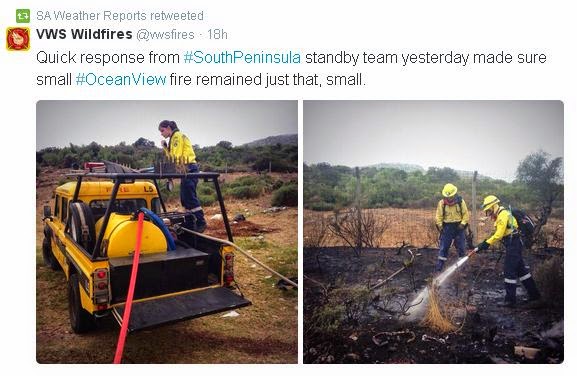
MSBWX National Disaster Observations:  Fires are burning again.  A large fire raged between Mossel Bay and Albertinia yesterday.  The N2 were closed and traffic were diverted via the Vleesbaai road.  Another large fire burned  last night in Vredehoek, Cape Town.  (Images: Twitter and as indicated underneath the images) Please be careful around open fires, throwing away cigarette butts and equipment that can start a fire. Be fire wise!


NSRI National Warnings and News: ------Nil

- MSBWX, SAWXREP + SAWS

Monday, 26 January 2015

#SAWeather and #Disaster #Observations South Africa : 26 January 2015 04h00 SAST - MSBWX


SAWS SEVERE WEATHER ALERTS: 
 
WARNINGS: ------Nil 

WATCHES: ------Nil  

SPECIAL WEATHER ADVISORIES: Hot and humid weather will result in extremely uncomfortable conditions in places over the eastern KwaZulu-Natal and the lowveld of Limpopo.  

MSBWX National Severe Weather Observations: Observations yesterday: Intense and dangerous lightning, strong wind, hail, heavy rain and flooding. (Gauteng,  Eastern Cape, Free State, Kwazulu Natal and Mpumalanga)


Images: Twitter and as indicated in each image.

MSBWX General Weather Observations:  Warm to very hot conditions expected today over parts of SA. Thunderstorms and rain showers can be expected in parts of  Gauteng, Mpumalanga, North West, Limpopo, Northern Cape, Western Cape, Eastern Cape, Kwazulu Natal and Free State. 

MSBWX National Disaster Observations: Fires: Fire fighting teams again battled several fires in the Western Cape.  A large fire also raged in Stikland at the SAB premises.


NSRI National Warnings and News


21 Rescued at Dappat se Gat:   At 16h25, Sunday, 25th January, NSRI Gordon’s Bay duty crew were activated by the Transnet National Ports Authority (TNPA) following reports of people trapped by the incoming tide on a cove cut off by high tide at Dappat Se Gat, Koegelbaai, between Gordons Bay and Pringle Bay. It appears that groups of people had gone onto the popular sightseeing rocky outcrop during the current new moon Spring low tide not realising that high tide would cut them off from mainland and that the Spring tides high tide risked engulfing the rocky outcrop. Some of the people, realising their predicament, called for help and on arrival on-scene NSRI rescuers confirmed that the risk of getting rescue swimmers onto the cove was too great in the incoming tide. Rescue craft would not be able to get close enough to extricate the group of people from the sea side without incredible risk. At that stage it was estimated that at least 16 people were trapped and NSRI Simonstown, WC Government Health EMS rescue squad and the Red Cross AMS Skymed rescue helicopter were activated. NSRI Simonstown dispatched the rescue craft SPIRIT OF SAFMARINE III and the Skymed rescue helicopter responded to join NSRI Gordons Bay rescue swimmers that were on the scene on the shore and NSRI Gordons Bay rescue craft SPIRIT OF SURFSKI and INGE (a Swedish rescue runner) that were standing by on the scene. Cape Town Fire and Rescue Services and the SA Police Services were also dispatched. The decision was taken to hoist as many people as possible in relays using the Skymed rescue helicopter before the high tide engulfed the cove. NSRI rescue swimmers and the rescue craft stood by to retrieve anyone who got swept into the ocean. It was then determined that a total of 20 people : 2 boys aged 7 and 8 years old, 10 adult men and 8 adult women. It appears that they were not aware of the new moon Spring tide and that the sea would cut off the popular rocky outcrop at high tide and risk being engulfed under water at high tide. (During normal tide these rocks are easily accessible even at high tide). A WC Government Health EMS rescue diver, Jason Higgins, was hoisted down from the Skymed rescue helicopter and supervised the successful rescue of all 20 people who were hoisted off by the rescue helicopter using a “short haul rescue technique”. Jason found all people safe. It appears that some of the people were unaware of the danger they were in but Jason called all of the people together and explained the situation and that they would all be extricated. As the tide rose, eventually everyone was huddled to a corner of the rocky outcrop and in relays of 5 persons at a time the “casualties” were kitted into harnesses by Jason and static line hoisted to mainland where additional rescuers were on hand to receive them. The rescue helicopter had reached its fuel limit when the last group were hoisted off and the helicopter was forced to return to base having successfully completed the rescue operation. It then emerged that one man was still trapped but he had not been in a position to indicate his entrapment due to the high seas and he was well hidden from view. Rescuers were only made aware of him after his wife indicated where the man had last been seen and that he remained outstanding. They are from Cape Town. A rescue team from Wilderness Search and Rescue (WSAR) was deployed from the land side and they rescued the 45 year old man after negotiating steep cliffs to reach the man. The rescued people were a group of people (16 people in total) from Kuils River aged between 28 and 34 and including the 7 year old and the 8 year old boy. From Pietermaritzburg, an elderly husband and wife. A Johannesburg adult man and the adult couple from Cape Town. In total 21 persons were rescued. When rescue teams were finally leaving the scene most of the rocks were engulfed by water. Even if the 21 people had huddled to the highest point it may only have been at around midnight tonight before they would have had any chance at low tide to get back to mainland and, dressed in normal day beach wear, it is predicted that most would have succumbed to hypothermia by then. A strong possibility that not all of the 21 people would have been able to remain on the cove in the incoming tide and at high tide and it is strongly suspected that a number of the people may have been swept into the sea. The rescue effort by the Red Cross AMS Skymed rescue helicopter team, WSAR, NSRI and the emergency services involved in this operation are commended for averting a mass casualty disaster today. - NSRI

All images: Twitter and as indicated in the images.

-MSBWX SAWXREP + SAWS

Sunday, 25 January 2015

#SAWeather and #Disaster #Observations South Africa : 25 January 2015 04h00 SAST - MSBWX


SAWS SEVERE WEATHER ALERTS: 
 
WARNINGS: Extremely high fire danger conditions expected over the southern interior of the Northern Cape Province, the northern interior of the West Coast District, central and eastern interior of the Western Cape, Central Karoo, Little Karoo and the extreme western parts of the Eastern Cape. 

WATCHES: ------Nil  

SPECIAL WEATHER ADVISORIES: Hot and humid weather will result in extremely uncomfortable conditions in places over the north-eastern parts of KZN .  

MSBWX National Severe Weather Observations: It was yesterday another humid and very hot day in parts of the Western, Northern and Eastern Cape.  Hail was reported in areas of Kwazulu Natal  and NE Free State.  No reports of any damage up to now. 


Images: Twitter and Storm Report SA

MSBWX General Weather Observations:  Warm to very hot conditions expected today over parts of SA. Thunderstorms and rain showers can be expected in parts of  Gauteng, Mpumalanga, North West, Limpopo, Northern Cape, Eastern Cape, Kwazulu Natal and Free State. 

MSBWX National Disaster Observations: Fires: WoF teams again battled several fires in the Western Cape.  High fire index.  NO OPEN FIRES TODAY - Fire fighters please be careful out there!


Images: Twitter and as indicated by each image.

NSRI National Warnings:------ Nil

- MSBWX + SAWXREP + SAWS

Thursday, 22 January 2015

#SAWeather and #Disaster #Observations South Africa : 22 January 2015 04h00 SAST - MSBWX

SAWS SEVERE WEATHER ALERTS: 
 
WARNINGS: Extremely high fire danger conditions are expected over the central interior of the Northern Cape, West Coast District, Cape Winelands, Overberg, Central Karoo and Eden District of the Western Cape.  

WATCHES: ------Nil  

SPECIAL WEATHER ADVISORIES: 1. Extremely hot conditions are expected over the western interior of the Northern Cape, West Coast District interior and south-western parts of the Cape Winelands today(Wednesday), including the Central and Little Karoo tomorrow(Thursday). 2. Hot and dry weather will result in extremely uncomfortable conditions over the interior of the Western and Northern Cape today(Wednesday) persisting until Friday. 3. Hot and humid weather will result in extremely uncomfortable conditions over the western half of the Eastern Cape.  

MSBWX National Severe Weather Observations:  Fairly intense thunderstorms were observed yesterday over Kwazulu Natal with small hail.  No damage reports were received up to now.


MSBWX General Weather Observations:  Cool, warm to very hot conditions expected today over parts of SA. Thunderstorms and rain showers can be expected in parts of  Gauteng, Mpumalanga, North West, Limpopo, Eastern Cape, Northern Cape, Kwazulu Natal and Free State. 

MSBWX National Disaster Observations: ----Nil

NSRI National Warnings:------ Nil

- MSBWX + SAWXREP + SAWS 

Wednesday, 21 January 2015

#SAWeather and #Disaster #Observations South Africa : 21 January 2015 04h00 SAST - MSBWX

SAWS SEVERE WEATHER ALERTS: 
 
WARNINGS: Extremely high fire danger conditions are expected over the central and northern interior of the Northern Cape, west coast and western interior of the Western Cape. 

WATCHES: Severe thunderstorms are expected over the south-western parts of KwaZulu-Natal tomorrow.  

SPECIAL WEATHER ADVISORIES: 1. Extremely hot conditions are expected over the west coast of the Western Cape and parts of the Breede River Valley. 2. Hot and dry weather will result in extremely uncomfortable conditions over the west coast and western interior of the Western Cape.  

MSBWX National Severe Weather Observations:  Fairly intense thunderstorm observed yesterday over Bloemfontein with heavy rain, flooding and small hail.


Images: Twitter via Traffic SA and StormReport SA

MSBWX General Weather Observations:  Cool, warm to very hot conditions expected today over parts of SA. Thunderstorms and rain showers can be expected in parts of  Gauteng, Mpumalanga, North West, Northern Cape, Kwazulu Natal and Free State. Drizzle can be expected in the Eastern Cape and Limpopo provinces.  

MSBWX National Disaster Observations:   Several veld fires were once again burning in the Western Cape. A large fire was observed near Danabay, Mossel Bay yesterday afternoon. 
Local fire fighters with the help of Working on Fire extinguished the fire during the early evening. It was great to see how the air-wing of Working on Fire time and again bombard the fire. A big thank you to all who assisted.


Images: MSBWX (Click on images for larger view.)
NSRI National Warnings:------ Nil

- MSBWX + SAWXREP + SAWS 

Saturday, 17 January 2015

#SAWeather and #Disaster #Observations South Africa : 17 January 2015 04h00 SAST - MSBWX

SAWS SEVERE WEATHER ALERTS: 
 
WARNINGS: -------Nil 

WATCHES: ----Nil 

SPECIAL WEATHER ADVISORIES: ----Nil 

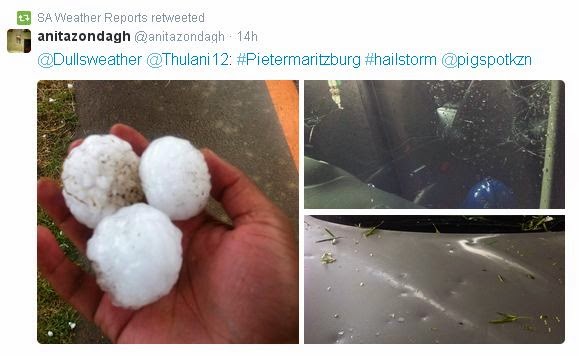
MSBWX National Severe Weather Observations:  What an interesting weather day yesterday.  It all started with a cold front meeting up with warm air that resulted in severe weather being experienced in areas of the country.  Provinces that bear the brunt were Gauteng, Western Cape, Eastern Cape and Kwazulu Natal. Large hail, intense lightning, heavy rain, gale force wind and flooding were reported. Provisional storm damage reports were received from Muizenberg, Port Elizabeth,  Uthungulu, Nkandla, Nxalala and Pietermatizburg. Several people were injured and houses and cars were damaged. Two people were struck by lightning in Kwazulu Natal.  Golf ball and egg size hail caused damage in Pietermaritzburg.  Images: Twitter and various observers as depicted in the images. (Click on images for larger view.)


Yesterday (16/1/2015) we experienced a classic weather phenomena were cold air met hot air, turns into severe weather and the above is the end result.  SAWXREP monitored temperatures throughout the day and it was obvious that severe weather were to be expected as temperatures dropped sharply as the front moved in over areas while hot and humid conditions were measured ahead of the cold front. Needless to say that all the other normal "ingredients" had to be present to form severe thunderstorms.


MSBWX General Weather Observations:  Cool, warm to hot conditions expected today over parts of SA. Thunderstorms and rain showers can be expected in parts of  Gauteng, Mpumalanga, Limpopo, North West and Free State. Isolated showers and rain can be expected in the Eastern Cape and Kwazulu Natal. 

MSBWX National Disaster Observations:  Several veld fires were again burning in parts of the Western Cape yesterday. 


NSRI National Warnings:------ Nil

- MSBWX + SAWXREP + SAWS