Showing posts with label Thunderstorm. Show all posts

Wednesday, 28 January 2015

#SAWeather and #Disaster #Observations South Africa : 28 January 2015 04h00 SAST - MSBWX

Image: Weather Underground (Click on image for larger view.)

SAWS SEVERE WEATHER ALERTS: 
 
WARNINGS: 1. Extremely high fire danger conditions are expected over the extreme western interior of the Northern Cape as well as over the interior of the West Coast District of the Western Cape. 2. Heavy rain and localized flooding in places is expected over KwaZulu-Natal, north-eastern part of the Free State, eastern part of the Northwest, Gauteng, Mpumalanga and southern part of Limpopo. 

WATCHES: -------Nil  

SPECIAL WEATHER ADVISORIES: ------Nil 

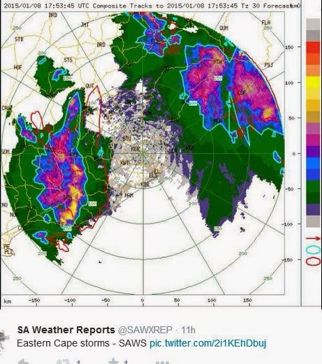
MSBWX National Severe Weather Observations: Intense thunderstorms and lightning with heavy rain in areas were observed yesterday in parts of Gauteng, Eastern Cape, Free State, North West, Mpumalanga and Kwazulu Natal. Up to 50 mm of rain was recorded in areas.  Further heavy rain and possible flooding is expected to continue in the next day or two in parts of KwaZulu-Natal, north-eastern part of the Free State, eastern part of the Northwest, Gauteng, Mpumalanga and southern part of Limpopo. 


Images: NCEP (Click on images for larger view.)

MSBWX General Weather Observations:  Warm to very hot conditions expected today over parts of SA. Thunderstorms and rain showers can be expected in parts of  Gauteng, Mpumalanga, North West, Limpopo, Northern Cape, Western Cape, Eastern Cape, Kwazulu Natal and Free State. 

MSBWX National Disaster Observations: Fires: Fire fighting teams again battled several fires in the Western Cape yesterday and this morning.  


NSRI National Warnings and News: ------Nil

- MSBWX, SAWXREP + SAWS

Sunday, 25 January 2015

#SAWeather and #Disaster #Observations South Africa : 25 January 2015 04h00 SAST - MSBWX


SAWS SEVERE WEATHER ALERTS: 
 
WARNINGS: Extremely high fire danger conditions expected over the southern interior of the Northern Cape Province, the northern interior of the West Coast District, central and eastern interior of the Western Cape, Central Karoo, Little Karoo and the extreme western parts of the Eastern Cape. 

WATCHES: ------Nil  

SPECIAL WEATHER ADVISORIES: Hot and humid weather will result in extremely uncomfortable conditions in places over the north-eastern parts of KZN .  

MSBWX National Severe Weather Observations: It was yesterday another humid and very hot day in parts of the Western, Northern and Eastern Cape.  Hail was reported in areas of Kwazulu Natal  and NE Free State.  No reports of any damage up to now. 


Images: Twitter and Storm Report SA

MSBWX General Weather Observations:  Warm to very hot conditions expected today over parts of SA. Thunderstorms and rain showers can be expected in parts of  Gauteng, Mpumalanga, North West, Limpopo, Northern Cape, Eastern Cape, Kwazulu Natal and Free State. 

MSBWX National Disaster Observations: Fires: WoF teams again battled several fires in the Western Cape.  High fire index.  NO OPEN FIRES TODAY - Fire fighters please be careful out there!


Images: Twitter and as indicated by each image.

NSRI National Warnings:------ Nil

- MSBWX + SAWXREP + SAWS

Friday, 23 January 2015

#SAWeather and #Disaster #Observations South Africa : 23 January 2015 04h00 SAST - MSBWX

SAWS SEVERE WEATHER ALERTS: 
 
WARNINGS: Extremely high fire danger conditions are expected in places over the interior of the Northern Cape, West Coast District, southwestern Cape Winelands and Central Karoo of the Western Cape. 

WATCHES: ------Nil  

SPECIAL WEATHER ADVISORIES: 1. Extremely hot conditions are expected over the western interior of the Northern Cape, West Coast District interior and the Central and Little Karoo of Western Cape. 2. Hot and humid weather will result in extremely uncomfortable conditions over the southwestern half of the Eastern Cape and over the interior of the Western and Northern Cape. 3. A heat wave with persistently high temperatures is expected over Central and Little Karoo of Western Cape until Saturday.  

MSBWX National Severe Weather Observations:  Fairly intense thunderstorms were observed yesterday over Mpumalanga. 


Images: Twitter via @SAWXREP (Click on image for larger view.)

MSBWX General Weather Observations:  Warm to very hot conditions expected today over parts of SA. Thunderstorms and rain showers can be expected in parts of  Gauteng, Mpumalanga, North West, Limpopo, Kwazulu Natal and Free State. 

MSBWX National Disaster Observations: Fires: WoF teams battling flames at Mandela Park, Wemmershoek and Tulbagh. 


Komatipoort: Brand verwoes vier winkels, drie karre - Vier winkels en drie motors is Donderdagoggend in ʼn brand in Komatipoort in Mpumalanga verwoes. “Die oorsaak van die brand is nog nie bekend nie,” het Cyril Ripinga, woordvoerder van die Nkomazi-munisipaliteit, gesê, het ʼn Sapa-korrespondent berig. “Dit is nie duidelik waar die brand ontstaan het nie, maar vier winkels, insluitend ʼn taverne, is afgebrand. Drie motors wat daar naby parkeer gestaan het, het ook uitgebrand.” Maroela Media het vroeër berig boere en inwoners van Komatipoort in Mpumalanga het Donderdag mense wat in ʼn brandende gebou in die dorp vasgekeer was gered, en gehelp om die brand te blus. Klik hier om meer te lees. Die eienaars van die gebou wou nie met die media praat nie.  - Maroela Media 

NSRI National Warnings:------ Nil

- MSBWX + SAWXREP + SAWS 

Friday, 9 January 2015

#SAWeather and #Disaster #Observations South Africa : 9 January 2015 04h00 SAST - MSBWX

SAWS SEVERE WEATHER ALERTS: 
 
WARNINGS: Extremely high fire danger conditions are expected over the eastern and central parts of the Northern Cape and extreme western parts of the North West province. 

WATCHES: -----Nil 

SPECIAL WEATHER ADVISORIES: Hot and humid weather will result in extremely uncomfortable conditions in places in the Lowveld of Limpopo.  

MSBWX National Severe Weather Observations:  Damaging thunderstorms and severe lightning lashed parts of the Eastern Cape yesterday afternoon and evening. 13 homes were damaged when a  severe storm hit Bedford in the Eastern Cape. Roofs were blown of and houses collapsed. Several people were injured and taken to hospital.  Flooding was again observed in Gauteng after heavy rain.  


Opdatering: Inwoners van Phola Park by Bedford in die Oos-Kaap herstel nog nadat `n swaar storm die woongebied getref het. Minstens dertien huise is beskadig en een het heeltemal ineengestort. Twee mense is in die hospitaal opgeneem nadat hul huise inmekaargeval het. Amptenare van die Nxuba-munisipaliteit is besig om die skade te bepaal. Die gemeenskap van Mbozisa het ook deurgeloop. Die dakke van verskeie huise is afgewaai. Die oeste van boere is ook beskadig. - RSG Nuus


In another incident Two women sustained moderate injuries and a man minor injuries when a tree collapsed on a taxi in West Street, Pietermaritzburg, yesterday. It is understood that the taxi driver was driving down the road during heavy downpour. The tree fell over and landed on the taxi leaving two women, in their 50s, trapped in the vehicle. When ER24 paramedics, and other services, arrived on scene, they found the tree lying across the windscreen and the front portion of the taxi’s roof. Patients were apparently flung to the back of the taxi when the incident occurred leaving two of them entrapped. The seats were pushed further down to free their legs which were wedged. Paramedics treated the patients and transported them to the Edendale Hospital. Local authorities were on scene. - ER24


MSBWX General Weather Observations:  Cool, warm to very hot conditions expected today over parts of SA. Thunderstorms and rain showers can be expected in parts of  Gauteng, Mpumalanga, Limpopo, North West, Northern Cape, Western Cape, Free State, Eastern Cape and Kwazulu Natal.  

MSBWX National Disaster Observations:  Several veld fires were again burning in parts of the Western Cape yesterday.  However fire fighting services quickly contained the fires.  


All images: Twitter and as mentioned in the images.

NSRI National Warnings:------ Nil

- MSBWX + SAWXREP + SAWS

Monday, 5 January 2015

#SAWeather and #Disaster #Observations South Africa : 5 January 2015 04h00 SAST - MSBWX

SAWS SEVERE WEATHER ALERTS: 
 
WARNINGS: Extremely high fire danger conditions are expected in places over the extreme western part of Northwest, the central and northern parts of the Northern Cape as well as the Little and Central Karoo of the Western Cape 

WATCHES: ----Nil

SPECIAL WEATHER ADVISORIES: Hot and humid weather will result in extremely uncomfortable conditions over the north-eastern parts of KwaZulu-Natal. nbsp;

MSBWX National Severe Weather Observations:  A few isolated thunderstorms reported yesterday in  Gauteng and Kwazulu Natal. Reports were received of pea size hail in areas yesterday, a waterspout that sinked boats  and an amazing but deadly lightning strike near the Albert Falls Dam, Pietermaritzburg. The Townbush Road Bridge partially collapsed after heavy rains in Kwazulu Natal over the weekend. Severe Weather indeed!


Images: Twitter via SAWXREP, Storm Report SA and The Witness (Click on images for larger view.)

MSBWX General Weather Observations: Cool, warm to very hot conditions expected today over parts of SA. Thunderstorms and rain showers can be expected in parts of  Gauteng, Mpumalanga, Limpopo, North West, Free State. Eastern Cape and Kwazulu Natal. Light rain is expected along the South-West coast of the Western Cape.

MSBWX National Disaster Observations: The Townbush Road Bridge partially collapsed after heavy rains in Kwazulu Natal over the weekend.


Image:    via Karen Christensen

NSRI National Warnings:------ Nil

- MSBWX + SAWXREP + SAWS

Saturday, 3 January 2015

#SAWeather and #Disaster #Observations South Africa : 3 January 2015 04h00 SAST - MSBWX

SAWS SEVERE WEATHER ALERTS: 
 
WARNINGS: Extremely high fire danger conditions are expected in places over the eastern parts of the Northern Cape.  

WATCHES: -----Nil

SPECIAL WEATHER ADVISORIES: Hot and humid weather will result in extremely uncomfortable conditions over the north-eastern parts of KwaZulu-Natal, Mpumalanga Lowveld and the southern Lowveld of Limpopo. 

MSBWX National Severe Weather Observations:  A few isolated thunderstorms occurred yesterday in the Eastern Cape (East London) and Kwazulu Natal (Ladysmith, Estcourt, Drakensberg area)  Although no severe weather reports were received of hail and heavy rain. 


Images: Twitter via StormReport SA

MSBWX General Weather Observations: Cool, warm to very hot conditions expected today over parts of SA. Thunderstorms and rain showers can be expected in parts of  Gauteng, Mpumalanga, Limpopo, North West, Free State, Eastern Cape and Kwazulu Natal.   

MSBWX National Disaster Observations:   Several drownings already occurred during the holiday season in South Africa. Drownings are preventable. Heed lifeguard warnings and swim under supervision, in demarcated and designated areas. We need to be vigilant and alert at all times especially were children are playing or swimming in water.

NSRI National Warnings: SPRING TIDE RIP CURRENT WARNING: With more people on the beaches at this time of the year NSRI are urging the public to be extra cautious between now and the 8th January during the Full Moon Spring Tide, which will peak on the full moon on Monday 05 January and that will cause stronger than normal rip currents around the coast starting from today, peaking on Monday 05th January and lasting until around the 09th January. NSRI are urging extreme public caution around the coast over the next 8 days. The main concern is that a lot of people will be on beaches over this weekend as the Spring Tide builds towards peaking on Monday 5th. The FULL MOON SPRING TIDE peaks on Monday 05th January. Very strong rip currents will be present around the coast from today and over the next 8 days. Bathers and shoreline anglers are most at risk and extreme caution is advised Spring Tide happens twice every month, at full moon and at new moon. Spring Tides bring a higher than normal high tide and a lower than normal low tide, causing stronger than normal rip currents, for a few days leading up to the full moon and the new moon, peaking on the day of the full moon and new moon and lasting for a few days after the full moon OR new moon. There are two high tides and two low tides every day. During Spring Tide the twice daily high tides are higher than normal and the twice daily low tides are lower than normal and while rip currents are always present and dangerous the Spring Tide creates stronger than normal rip currents and hence the danger is increased. Rip Currents are caused when the water reaching the shoreline in waves, swells and sea currents needs to find a way to retreat back into the sea and this is achieved in rip currents (a river of water retreating through the incoming swells back out into the sea). There are two types of rip currents, permanent rip currents, found alongside islands, rocky outcrops jutting into the sea, at river mouths, in between reefs and alongside harbour walls and piers, are found constantly occurring in the same place allowing the water reaching the shoreline to retreat back into the sea in the permanent rip current. Temporary rip currents, found along beach fronts (along the shoreline), are forever changing their position and are unpredictable and can form suddenly along a beach front without warning at different places along the shore front throughout the day. During Spring Tide these permanent rip currents and temporary rip currents are stronger than normal and although rip currents at all times pose a danger to bathers they pose the greatest danger during the Spring Tide. Bathers are at risk of being swept out to sea by rip currents while swimming or wading in water along the beach front. Even bathers wading in shallow water who find themselves trapped in a rip current that forms suddenly are at risk of being swept out to sea by rip currents. Bathers caught in a rip current should not panic. Simply stay afloat by treading water (moving your arms and legs in circular movements), don’t try to swim against the current as it will only cause you exhaustion and let the current sweep you out to sea but at your first opportunity swim parallel to the beach front until you are free of the rip current and then use the incoming waves to get back to shore. While this is happening scream for help and wave your arm to alert people on the beach to raise the alarm. Swim at beaches where lifeguards are on duty and obey the instructions of the lifeguards and only swim within the safe swimming zones lifeguards mark (using their red and yellow flags). Children should have responsible adult supervision at all times around coastal and inland waters and at swimming pools. Anglers fishing along the shoreline, particularly along rocks on the shoreline, are at greatest risk during the Spring Tide where incoming waves during the high tides engulf higher than normal over rocks. Anglers should not turn their back to the sea and should be vigilant and cautious of the wave action at all times while fishing. Boaters, paddlers, sail boarders and anyone launching any kind of craft onto water should wear their life-jackets at all times while on water and carry easily accessible safety equipment - red distress flares, communications cellphone or VHF radio with fully charged batteries in water tight plastic sleeves, a waterproof torch, highly visible neon coloured clothing, a referee whistle worn around the neck, a silver emergency foil blanket, and let a responsible person know your time of departure, your exact intended route and your estimated return time, stick to your plans and check in with the responsible person on your safe return. (If you are overdue the responsible person should raise the alarm without hesitation). -ENDS- TO REPORT A SEA RESCUE EMERGENCY DIAL 112 FROM A CELLPHONE  - NSRI

- MSBWX + SAWXREP + SAWS

Sunday, 28 December 2014

Final Update: #SevereWeather, #HeavyRain #Flashflooding expected during the period 26 - 29 December 2014 in SA

This morning the Tropical Low Pressure system appeared to have fizzled out with only a few convective storms and cirrus clouds around in parts of Limpopo, Mpumalanga and Gauteng. Please note that their is still plenty of moist air around and with enough instability could still result in thunderstorms, heavy rain and flooding in the above mentioned areas. The system appear to weaken at night time and strengthen during the day, with some isolated developing convective cells mainly appearing in the afternoon.


Severe weather is expected with damaging results if this system intensifies again this afternoon. A word of advise to holidaymakers near rivers, low water bridges, ravines, estuaries, low lying area and areas prone to flooding or flash flooding: Be on high alert for the above period (27 - 29 December 2014)

What can we expect from this system:
1. Always the possibility of Severe Weather
2. Moderate to heavy rain (50mm or more in places)
3. Strong winds
4. Possibility of Flooding or flash flooding
5. Colder weather conditions
6. Possible Severe thunderstorms
7. Possible Hail
8. Possible storm or flood damage 

Finally: As always do not underestimate any weather system. MSBWX will monitor this system closely and will bring you updates as this system moves across the country.

SAWXREP need your real time weather observations i.o.w. if you observe heavy rain, flooding, strong wind, rough seas, storm damage etc. Please inform the SAWXREP so that we in turn can keep the public informed. Tweet us at @SAWXREP . Do not assume that SAWXREP knows for certain that severe weather has occurred. Help us to spread the word about severe weather and NEVER assume that your weather observation report is not important.

SAWXREP would like to hear from you.

Images: Eumetsat, NCEP (Click on images for larger view.)

 - MSBWX + SAWXREP 

Saturday, 27 December 2014

Update 2: #SevereWeather, #HeavyRain #Flashflooding expected during the period 26 - 31 December 2014 in SA

This morning we have a more defined system over the country that is already depositing heavy rain in areas.


Reports of heavy rain, flooding and thunderstorms were received  this morning from East London. Tropical moist air is currently moving in over parts of the country. A fairly intense cloud base is currently situated over parts of the North West and central Free State.


Further heavy rain (>50mm), severe thunderstorms with possible hail and flooding are expected for the above period over parts of Gauteng, Limpopo, North West, Free State, Mpumalanga and the Eastern Cape.


Severe weather is expected with damaging results if this system intensifies further. A word of advise to holidaymakers near rivers, low water bridges, ravines, estuaries, low lying area and areas prone to flooding or flash flooding: Be on high alert for the above period (27 - 31 December 2014)

What can we expect from this system:
1. Always the possibility of Severe Weather
2. Moderate to heavy rain (50mm or more in places)
3. Strong winds
4. Possibility of Flooding or flash flooding
5. Colder weather conditions
6. Possible Severe thunderstorms
7. Possible Hail
8. Possible storm or flood damage

Finally: As always do not underestimate any weather system. MSBWX will monitor this system closely and will bring you updates as this system moves across the country.

SAWXREP need your real time weather observations i.o.w. if you observe heavy rain, flooding, strong wind, rough seas, storm damage etc. Please inform the SAWXREP so that we in turn can keep the public informed. Tweet us at @SAWXREP . Do not assume that SAWXREP knows for certain that severe weather has occurred. Help us to spread the word about severe weather and NEVER assume that your weather observation report is not important.

SAWXREP would like to hear from you.

Images: Eumetsat, Weather Underground, NCEP, SAT24 (Click on images for larger view.)

 - MSBWX + SAWXREP


Thursday, 11 December 2014

SA National Weather and Disaster Observations: 11 December 2014 04h00 SAST - MSBWX

SAWS SEVERE WEATHER ALERTS: 

WARNINGS: ------- Nil  

WATCHES: Severe thunderstorms are possible over the western parts of KwaZulu-Natal. 

SPECIAL WEATHER ADVISORIES: ------ Nil  

MSBWX National Severe Weather Observations:  

Yesterday severe weather was observed in parts of Gauteng and Kwazulu Natal. Heavy rain, hail and flash flooding were observed.  No reports of serious damage thus far. Images: Storm Report SA, Traffic SA, Gauteng Weather, Twitter and Facebook.


MSBWX General Weather Observations: Cool, warm to hot conditions expected today over parts of SA. Thunderstorms and rain showers can be expected in parts of  Gauteng, Mpumalanga, Limpopo, North West, Northern Cape, Free State,Northern Cape, Western Cape, Eastern Cape and Kwazulu Natal.  

MSBWX National Disaster Observations: The fire in the Gouritz area (Southern Cape) is still burning.  Fire fighters are fighting the fire now for the fith consecutive day. Image: Working on Fire.


NSRI National Warnings:  ------Nil 

- MSBWX + SAWXREP + SAWS