ARTICLE: NICKEY LE ROUX, MOSSEL BAY ADVERTISER JOURNALIST
Weather and Disaster related posts relating to the Western- and Southern Cape Areas. Also some interesting worldwide weather,disaster and space weather/mission posts at times.
Pages
- Home
- Disclaimer/Indemnity: Mossel Bay Weather 2013
- SCP/Garden Route Private WX Stations
- SCP/Garden Route Webcams
- SA Historical WX and Disaster Events
- Interactive WX Map: SCP/Garden Route
- WX Prediction: Mossel Bay, George, Knysna, Plett and Oudtshoorn
- DIY Weather and Disaster Projects Page
- Upper Level Sigwx Chart
Showing posts with label Sea Rescue. Show all posts
Friday, 23 January 2015
#Mosselbay - Yacht cruise turns nasty #SeaRescue #NSRI
ARTICLE: NICKEY LE ROUX, MOSSEL BAY ADVERTISER JOURNALIST
Labels:
NSRI,
Sea Rescue
Saturday, 3 January 2015
#SAWeather and #Disaster #Observations South Africa : 3 January 2015 04h00 SAST - MSBWX
SAWS SEVERE WEATHER ALERTS:
WARNINGS: Extremely high fire danger conditions are expected in places over the eastern parts of the Northern Cape.
WATCHES: -----Nil
SPECIAL WEATHER ADVISORIES: Hot and humid weather will result in extremely uncomfortable conditions over the north-eastern parts of KwaZulu-Natal, Mpumalanga Lowveld and the southern Lowveld of Limpopo.
MSBWX National Severe Weather Observations: A few isolated thunderstorms occurred yesterday in the Eastern Cape (East London) and Kwazulu Natal (Ladysmith, Estcourt, Drakensberg area) Although no severe weather reports were received of hail and heavy rain.
Images: Twitter via StormReport SA
MSBWX General Weather Observations: Cool, warm to very hot conditions expected today over parts of SA. Thunderstorms and rain showers can be expected in parts of Gauteng, Mpumalanga, Limpopo, North West, Free State, Eastern Cape and Kwazulu Natal.
MSBWX National Disaster Observations: Several drownings already occurred during the holiday season in South Africa. Drownings are preventable. Heed lifeguard warnings and swim under supervision, in demarcated and designated areas. We need to be vigilant and alert at all times especially were children are playing or swimming in water.
NSRI National Warnings: SPRING TIDE RIP CURRENT WARNING: With more people on the beaches at this time of the year NSRI are urging the public to be extra cautious between now and the 8th January during the Full Moon Spring Tide, which will peak on the full moon on Monday 05 January and that will cause stronger than normal rip currents around the coast starting from today, peaking on Monday 05th January and lasting until around the 09th January. NSRI are urging extreme public caution around the coast over the next 8 days. The main concern is that a lot of people will be on beaches over this weekend as the Spring Tide builds towards peaking on Monday 5th. The FULL MOON SPRING TIDE peaks on Monday 05th January. Very strong rip currents will be present around the coast from today and over the next 8 days. Bathers and shoreline anglers are most at risk and extreme caution is advised Spring Tide happens twice every month, at full moon and at new moon. Spring Tides bring a higher than normal high tide and a lower than normal low tide, causing stronger than normal rip currents, for a few days leading up to the full moon and the new moon, peaking on the day of the full moon and new moon and lasting for a few days after the full moon OR new moon. There are two high tides and two low tides every day. During Spring Tide the twice daily high tides are higher than normal and the twice daily low tides are lower than normal and while rip currents are always present and dangerous the Spring Tide creates stronger than normal rip currents and hence the danger is increased. Rip Currents are caused when the water reaching the shoreline in waves, swells and sea currents needs to find a way to retreat back into the sea and this is achieved in rip currents (a river of water retreating through the incoming swells back out into the sea). There are two types of rip currents, permanent rip currents, found alongside islands, rocky outcrops jutting into the sea, at river mouths, in between reefs and alongside harbour walls and piers, are found constantly occurring in the same place allowing the water reaching the shoreline to retreat back into the sea in the permanent rip current. Temporary rip currents, found along beach fronts (along the shoreline), are forever changing their position and are unpredictable and can form suddenly along a beach front without warning at different places along the shore front throughout the day. During Spring Tide these permanent rip currents and temporary rip currents are stronger than normal and although rip currents at all times pose a danger to bathers they pose the greatest danger during the Spring Tide. Bathers are at risk of being swept out to sea by rip currents while swimming or wading in water along the beach front. Even bathers wading in shallow water who find themselves trapped in a rip current that forms suddenly are at risk of being swept out to sea by rip currents. Bathers caught in a rip current should not panic. Simply stay afloat by treading water (moving your arms and legs in circular movements), don’t try to swim against the current as it will only cause you exhaustion and let the current sweep you out to sea but at your first opportunity swim parallel to the beach front until you are free of the rip current and then use the incoming waves to get back to shore. While this is happening scream for help and wave your arm to alert people on the beach to raise the alarm. Swim at beaches where lifeguards are on duty and obey the instructions of the lifeguards and only swim within the safe swimming zones lifeguards mark (using their red and yellow flags). Children should have responsible adult supervision at all times around coastal and inland waters and at swimming pools. Anglers fishing along the shoreline, particularly along rocks on the shoreline, are at greatest risk during the Spring Tide where incoming waves during the high tides engulf higher than normal over rocks. Anglers should not turn their back to the sea and should be vigilant and cautious of the wave action at all times while fishing. Boaters, paddlers, sail boarders and anyone launching any kind of craft onto water should wear their life-jackets at all times while on water and carry easily accessible safety equipment - red distress flares, communications cellphone or VHF radio with fully charged batteries in water tight plastic sleeves, a waterproof torch, highly visible neon coloured clothing, a referee whistle worn around the neck, a silver emergency foil blanket, and let a responsible person know your time of departure, your exact intended route and your estimated return time, stick to your plans and check in with the responsible person on your safe return. (If you are overdue the responsible person should raise the alarm without hesitation). -ENDS- TO REPORT A SEA RESCUE EMERGENCY DIAL 112 FROM A CELLPHONE - NSRI
- MSBWX + SAWXREP + SAWS
WARNINGS: Extremely high fire danger conditions are expected in places over the eastern parts of the Northern Cape.
WATCHES: -----Nil
SPECIAL WEATHER ADVISORIES: Hot and humid weather will result in extremely uncomfortable conditions over the north-eastern parts of KwaZulu-Natal, Mpumalanga Lowveld and the southern Lowveld of Limpopo.
MSBWX National Severe Weather Observations: A few isolated thunderstorms occurred yesterday in the Eastern Cape (East London) and Kwazulu Natal (Ladysmith, Estcourt, Drakensberg area) Although no severe weather reports were received of hail and heavy rain.
Images: Twitter via StormReport SA
MSBWX General Weather Observations: Cool, warm to very hot conditions expected today over parts of SA. Thunderstorms and rain showers can be expected in parts of Gauteng, Mpumalanga, Limpopo, North West, Free State, Eastern Cape and Kwazulu Natal.
MSBWX National Disaster Observations: Several drownings already occurred during the holiday season in South Africa. Drownings are preventable. Heed lifeguard warnings and swim under supervision, in demarcated and designated areas. We need to be vigilant and alert at all times especially were children are playing or swimming in water.
NSRI National Warnings: SPRING TIDE RIP CURRENT WARNING: With more people on the beaches at this time of the year NSRI are urging the public to be extra cautious between now and the 8th January during the Full Moon Spring Tide, which will peak on the full moon on Monday 05 January and that will cause stronger than normal rip currents around the coast starting from today, peaking on Monday 05th January and lasting until around the 09th January. NSRI are urging extreme public caution around the coast over the next 8 days. The main concern is that a lot of people will be on beaches over this weekend as the Spring Tide builds towards peaking on Monday 5th. The FULL MOON SPRING TIDE peaks on Monday 05th January. Very strong rip currents will be present around the coast from today and over the next 8 days. Bathers and shoreline anglers are most at risk and extreme caution is advised Spring Tide happens twice every month, at full moon and at new moon. Spring Tides bring a higher than normal high tide and a lower than normal low tide, causing stronger than normal rip currents, for a few days leading up to the full moon and the new moon, peaking on the day of the full moon and new moon and lasting for a few days after the full moon OR new moon. There are two high tides and two low tides every day. During Spring Tide the twice daily high tides are higher than normal and the twice daily low tides are lower than normal and while rip currents are always present and dangerous the Spring Tide creates stronger than normal rip currents and hence the danger is increased. Rip Currents are caused when the water reaching the shoreline in waves, swells and sea currents needs to find a way to retreat back into the sea and this is achieved in rip currents (a river of water retreating through the incoming swells back out into the sea). There are two types of rip currents, permanent rip currents, found alongside islands, rocky outcrops jutting into the sea, at river mouths, in between reefs and alongside harbour walls and piers, are found constantly occurring in the same place allowing the water reaching the shoreline to retreat back into the sea in the permanent rip current. Temporary rip currents, found along beach fronts (along the shoreline), are forever changing their position and are unpredictable and can form suddenly along a beach front without warning at different places along the shore front throughout the day. During Spring Tide these permanent rip currents and temporary rip currents are stronger than normal and although rip currents at all times pose a danger to bathers they pose the greatest danger during the Spring Tide. Bathers are at risk of being swept out to sea by rip currents while swimming or wading in water along the beach front. Even bathers wading in shallow water who find themselves trapped in a rip current that forms suddenly are at risk of being swept out to sea by rip currents. Bathers caught in a rip current should not panic. Simply stay afloat by treading water (moving your arms and legs in circular movements), don’t try to swim against the current as it will only cause you exhaustion and let the current sweep you out to sea but at your first opportunity swim parallel to the beach front until you are free of the rip current and then use the incoming waves to get back to shore. While this is happening scream for help and wave your arm to alert people on the beach to raise the alarm. Swim at beaches where lifeguards are on duty and obey the instructions of the lifeguards and only swim within the safe swimming zones lifeguards mark (using their red and yellow flags). Children should have responsible adult supervision at all times around coastal and inland waters and at swimming pools. Anglers fishing along the shoreline, particularly along rocks on the shoreline, are at greatest risk during the Spring Tide where incoming waves during the high tides engulf higher than normal over rocks. Anglers should not turn their back to the sea and should be vigilant and cautious of the wave action at all times while fishing. Boaters, paddlers, sail boarders and anyone launching any kind of craft onto water should wear their life-jackets at all times while on water and carry easily accessible safety equipment - red distress flares, communications cellphone or VHF radio with fully charged batteries in water tight plastic sleeves, a waterproof torch, highly visible neon coloured clothing, a referee whistle worn around the neck, a silver emergency foil blanket, and let a responsible person know your time of departure, your exact intended route and your estimated return time, stick to your plans and check in with the responsible person on your safe return. (If you are overdue the responsible person should raise the alarm without hesitation). -ENDS- TO REPORT A SEA RESCUE EMERGENCY DIAL 112 FROM A CELLPHONE - NSRI
- MSBWX + SAWXREP + SAWS
Sunday, 28 December 2014
#SAWeather and #Disaster #Observations South Africa : 28 December 2014 04h00 SAST - MSBWX
SAWS SEVERE WEATHER ALERTS:
PLEASE NOTE THAT THE SAWS DID NOT UPDATE THEIR PDF REGIONAL WEATHER WARNINGS/FORECAST THIS MORNING.
WARNINGS: No update by SAWS
WATCHES: No update by SAWS
SPECIAL WEATHER ADVISORIES: No update by SAWS
MSBWX National Severe Weather Observations: Heavy rain and flooding were observed in parts of Gauteng, Eastern Cape and the North West Province yesterday. No reports of serious damage was received.
Further heavy rain, thunderstorms and flooding is expected in parts of Gauteng, Limpopo and Mpumalanga Provinces today.
MSBWX General Weather Observations: Cool, warm to very hot conditions expected today over parts of SA. Thunderstorms and rain showers can be expected in parts of Gauteng, Mpumalanga, Limpopo, North West, Free State and Kwazulu Natal. Rough seas is still expected along the Western- , Eastern Cape and Kwazulu Natal coast up until Wednesday this week. Holiday makers are advised to take note of the rough sea conditions. Boaters, paddlers, sail boarders and anyone launching any kind of craft onto water are advised to stay ashore until the sea conditions improved. Bathers must only swim where life guards are on duty and in demarcated areas.
MSBWX National Disaster Observations:An AirAsia plane with 162 people aboard lost contact with ground control soon after takeoff from Indonesia this morning. Search is underway. More info follow @SAWXREP
NSRI National Warnings: NSRI are urging bathers to be extremely cautious while rough seas and strong rip currents continue to be experienced around the coast. TO REPORT A SEA RESCUE EMERGENCY DIAL 112 FROM A CELLPHONE
- MSBWX + SAWXREP + SAWS
PLEASE NOTE THAT THE SAWS DID NOT UPDATE THEIR PDF REGIONAL WEATHER WARNINGS/FORECAST THIS MORNING.
WARNINGS: No update by SAWS
WATCHES: No update by SAWS
SPECIAL WEATHER ADVISORIES: No update by SAWS
MSBWX National Severe Weather Observations: Heavy rain and flooding were observed in parts of Gauteng, Eastern Cape and the North West Province yesterday. No reports of serious damage was received.
Further heavy rain, thunderstorms and flooding is expected in parts of Gauteng, Limpopo and Mpumalanga Provinces today.
MSBWX General Weather Observations: Cool, warm to very hot conditions expected today over parts of SA. Thunderstorms and rain showers can be expected in parts of Gauteng, Mpumalanga, Limpopo, North West, Free State and Kwazulu Natal. Rough seas is still expected along the Western- , Eastern Cape and Kwazulu Natal coast up until Wednesday this week. Holiday makers are advised to take note of the rough sea conditions. Boaters, paddlers, sail boarders and anyone launching any kind of craft onto water are advised to stay ashore until the sea conditions improved. Bathers must only swim where life guards are on duty and in demarcated areas.
MSBWX National Disaster Observations:An AirAsia plane with 162 people aboard lost contact with ground control soon after takeoff from Indonesia this morning. Search is underway. More info follow @SAWXREP
NSRI National Warnings: NSRI are urging bathers to be extremely cautious while rough seas and strong rip currents continue to be experienced around the coast. TO REPORT A SEA RESCUE EMERGENCY DIAL 112 FROM A CELLPHONE
- MSBWX + SAWXREP + SAWS
Saturday, 27 December 2014
#SAWeather and #Disaster #Observations South Africa : 27 December 2014 04h00 SAST - MSBWX
SAWS SEVERE WEATHER ALERTS:
WARNINGS: -----Nil
WATCHES: Heavy rain that may lead to localised flooding expected in places over Gauteng, Limpopo, eastern parts of North West, central and eastern Free State,extreme northern and western Mpumalanga and the eastern parts of the Eastern Cape.
SPECIAL WEATHER ADVISORIES: An intense tropical low pressure system is expected to move over Botswana, resulting in tropical moisture over the eastern and northern parts of South Africa from early hours on Saturday morning and into Monday. The public is advised that heavy rain and flooding can be expected.
MSBWX National Severe Weather Observations: Rough sea conditions during spring high tide in the early hours of this morning (Friday, 26th December) caused some flood damage to some roads, and to some houses, CoCT Disaster Risk Management evacuated a camping site at Silverstroomstrand. In some cases debris, kelp and flotsam washed onto some beaches and over some roads along parts of the West Coast and a part of the False Bay Coast. City of Cape Town Disaster Risk Management conducted mopping up operations where areas were affected and relocated to higher ground affected campers at a camp site in Silverstroomstrand. Areas along the coast that were affected by rough seas during the early hours of this morning, were Melkbosstrand, Milnerton, Hout Bay, Kleinbaai, part of Bloubergstrand, Derde Steen, Tweede Steen, Riebeekstrand, Silverstroomstrand – on the West Coast and parts of Baden Powell Drive – on the False Bay Coast which has been temporarily closed by authorities due to debris and sea sand washed onto the road and cleaning operations are underway by the City of Cape Town authorities to reopen Baden Powell Drive. NSRI, Lifeguards and the Emergency Services have been placed on high alert today.
Images: NSRI (Click on images for larger view)
Holiday makers along Atlantic coastline left underwater by high tide conditions
Images: Disaster Management Cape Town (Click on images for larger view.)
· Campers at Silwerstroomstrand beach moved to higher ground
· Flood waters receding after 8 metre of wave heights occurred during early hours of the morning
· Disaster management and other public safety authorities placed on high-alert for expected further above normal high tides this evening
· South African Weather Service issued warning of high seas with wave heights from 6-9m expected between Cape Columbine and Plettenberg Bay today (Friday)
· Appeal made to homeowners, bathers and campers to exercise extreme caution due to big swells along coastlines
· Three bathers rescued after been washed off Kalk Bay Harbour seawall Coastal towns and resorts along the Atlantic and False Bay coastline were left swamped after tidal surge during the early hours of this morning forced closure of beach roads and campers to move to higher ground.
Although flood waters were reported to be receding, the weather warning remains in force for high seas with wave heights from 6 – 9 metres expected for the remainder of the day (Friday) between Cape Columbine and Plettenberg Bay. At 06:00 AM this morning the South African Weather Service observed high tides peaking at 8 metres at Slangkop near Cape Point. The high tide conditions resulted in flooding of roads and camping areas due to the rough sea conditions during Spring High Tide in the early hours. The City’s disaster response teams commenced with mopping-up the Baden Powell coastal Road between Muizenberg and Strandfontein that was completely flooded after 06:00 AM this morning. The roadway will remain closed under the area has been cleared and made safe. The City’s Disaster Risk Management Centre confirms that the rough seas and high tide conditions did not claim any lives, however it caused major disruption on roadways and camping areas at coastal resorts this morning. Between 05:00 and 06:00 this morning whilst most of holidaymakers were asleep tidal waters flooded tent and caravan camping sites at Ganzekraal on the West Coast, Silwerstroomstrand Beach near Mamre and Atlantis as well as the coastline between Melkbosstrand until Milnerton Lagoon on the Atlantic Seaboard. The chalets at the Kleinbaai Resort near Melkbosstrand were standing under water this morning and stagnant water was visible in the recreational areas. The subway at Dalebrook Tidal Pool was completely flood and benches have washed into the pool. The coastal roads between Hout Bay, Kalk Bay, Muizenberg, Strandfontein, Gordon’s Bay and Strand along the False Bay coastline were also flooded. The City of Cape Town commenced with relocating holidaymakers to higher ground and mopping-up coastal roads from debris, kelp and flotsam. The high tide this morning had prompted fears of further flooding but passed without major incident. An appeal is made to members of the public and bathers to pay very close attention to advice from the disaster management officials, law enforcement authorities and emergency services. The Cape Town Office of the South African Weather Service predicts that temperatures would be mild over the weekend between 20 and 22 degrees Celsius. The City’s has placed disaster response teams and other public safety authorities on high-alert for another possible flood event this evening at 18:00 PM during high tide. The public are reminded that there will be a second high tide this evening and, although not anticipated to cause problems, there is still the potential for flooding of coastal areas. The City is monitoring the situation and if the circumstances worsen support and cooperation from other government entities and auxiliary organisations will be invoked. The National Sea Rescue Institute (NSRI), lifeguards and emergency services will remain on high alert throughout the day. This morning on-duty lifeguards rescued three (3) bathers that were washed off the Kalk Bay Harbour seawall by rough sea conditions. A general caution is issued urging 'sightseers' and bathers to stay away from harbours, seawalls and rocks and exercising caution at tidal pools due to massive swells and rough sea conditions. The City of Cape Town will continue to monitor further developments relating to the weather system. The public is urged to regularly follow weather forecasts on television and radio.
- Disaster Management Cape Town
MSBWX General Weather Observations: Cool, warm to very hot conditions expected today over parts of SA. Thunderstorms and rain showers can be expected in parts of Gauteng, Mpumalanga, Limpopo, North West, Northern Cape, Western Cape (Karoo), Free State and Kwazulu Natal. Rough seas is still expected along the Western- , Eastern Cape and Kwazulu Natal coast this weekend. Holiday makers are advised to take note of the rough sea conditions. Boaters, paddlers, sail boarders and anyone launching any kind of craft onto water are advised to stay ashore until the sea conditions improved. Bathers must only swim where life guards are on duty and in demarcated areas.
MSBWX National Disaster Observations: -----Nil
NSRI National Warnings: Tidal surge caused 150 people to be swept out to sea: Lifeguards have confirmed that a drowning victim, an adult male, has not been recovered at Salmon Bay, Ballito following a drowning accident. Then at Addington Beach, Durban, lifeguards reported that a tidal surge caused 150 people to be swept out to sea. One person, an adult male, drowned and his body was recovered. Ethekweni lifeguards rescued the people and KZN-EMRS paramedics treated 40 people for near drowning symptoms but none were required to be transported to hospital. At 16h39, Friday, 26th December, NSRI Durban responded to Addington Beach following reports of a mass drowning incident. On arrival on-scene Ethekweni lifeguards and KZN EMRS confirmed that all people (unknown to NSRI the number of people involved) had been rescued from the surf by lifeguards and required no further assistance. NSRI are urging bathers to be extremely cautious over this weekend while rough seas and strong rip currents continue to be experienced around the coast. TO REPORT A SEA RESCUE EMERGENCY DIAL 112 FROM A CELLPHONE
- MSBWX + SAWXREP + SAWS
WARNINGS: -----Nil
WATCHES: Heavy rain that may lead to localised flooding expected in places over Gauteng, Limpopo, eastern parts of North West, central and eastern Free State,extreme northern and western Mpumalanga and the eastern parts of the Eastern Cape.
SPECIAL WEATHER ADVISORIES: An intense tropical low pressure system is expected to move over Botswana, resulting in tropical moisture over the eastern and northern parts of South Africa from early hours on Saturday morning and into Monday. The public is advised that heavy rain and flooding can be expected.
MSBWX National Severe Weather Observations: Rough sea conditions during spring high tide in the early hours of this morning (Friday, 26th December) caused some flood damage to some roads, and to some houses, CoCT Disaster Risk Management evacuated a camping site at Silverstroomstrand. In some cases debris, kelp and flotsam washed onto some beaches and over some roads along parts of the West Coast and a part of the False Bay Coast. City of Cape Town Disaster Risk Management conducted mopping up operations where areas were affected and relocated to higher ground affected campers at a camp site in Silverstroomstrand. Areas along the coast that were affected by rough seas during the early hours of this morning, were Melkbosstrand, Milnerton, Hout Bay, Kleinbaai, part of Bloubergstrand, Derde Steen, Tweede Steen, Riebeekstrand, Silverstroomstrand – on the West Coast and parts of Baden Powell Drive – on the False Bay Coast which has been temporarily closed by authorities due to debris and sea sand washed onto the road and cleaning operations are underway by the City of Cape Town authorities to reopen Baden Powell Drive. NSRI, Lifeguards and the Emergency Services have been placed on high alert today.
Images: NSRI (Click on images for larger view)
Holiday makers along Atlantic coastline left underwater by high tide conditions
Images: Disaster Management Cape Town (Click on images for larger view.)
· Campers at Silwerstroomstrand beach moved to higher ground
· Flood waters receding after 8 metre of wave heights occurred during early hours of the morning
· Disaster management and other public safety authorities placed on high-alert for expected further above normal high tides this evening
· South African Weather Service issued warning of high seas with wave heights from 6-9m expected between Cape Columbine and Plettenberg Bay today (Friday)
· Appeal made to homeowners, bathers and campers to exercise extreme caution due to big swells along coastlines
· Three bathers rescued after been washed off Kalk Bay Harbour seawall Coastal towns and resorts along the Atlantic and False Bay coastline were left swamped after tidal surge during the early hours of this morning forced closure of beach roads and campers to move to higher ground.
Although flood waters were reported to be receding, the weather warning remains in force for high seas with wave heights from 6 – 9 metres expected for the remainder of the day (Friday) between Cape Columbine and Plettenberg Bay. At 06:00 AM this morning the South African Weather Service observed high tides peaking at 8 metres at Slangkop near Cape Point. The high tide conditions resulted in flooding of roads and camping areas due to the rough sea conditions during Spring High Tide in the early hours. The City’s disaster response teams commenced with mopping-up the Baden Powell coastal Road between Muizenberg and Strandfontein that was completely flooded after 06:00 AM this morning. The roadway will remain closed under the area has been cleared and made safe. The City’s Disaster Risk Management Centre confirms that the rough seas and high tide conditions did not claim any lives, however it caused major disruption on roadways and camping areas at coastal resorts this morning. Between 05:00 and 06:00 this morning whilst most of holidaymakers were asleep tidal waters flooded tent and caravan camping sites at Ganzekraal on the West Coast, Silwerstroomstrand Beach near Mamre and Atlantis as well as the coastline between Melkbosstrand until Milnerton Lagoon on the Atlantic Seaboard. The chalets at the Kleinbaai Resort near Melkbosstrand were standing under water this morning and stagnant water was visible in the recreational areas. The subway at Dalebrook Tidal Pool was completely flood and benches have washed into the pool. The coastal roads between Hout Bay, Kalk Bay, Muizenberg, Strandfontein, Gordon’s Bay and Strand along the False Bay coastline were also flooded. The City of Cape Town commenced with relocating holidaymakers to higher ground and mopping-up coastal roads from debris, kelp and flotsam. The high tide this morning had prompted fears of further flooding but passed without major incident. An appeal is made to members of the public and bathers to pay very close attention to advice from the disaster management officials, law enforcement authorities and emergency services. The Cape Town Office of the South African Weather Service predicts that temperatures would be mild over the weekend between 20 and 22 degrees Celsius. The City’s has placed disaster response teams and other public safety authorities on high-alert for another possible flood event this evening at 18:00 PM during high tide. The public are reminded that there will be a second high tide this evening and, although not anticipated to cause problems, there is still the potential for flooding of coastal areas. The City is monitoring the situation and if the circumstances worsen support and cooperation from other government entities and auxiliary organisations will be invoked. The National Sea Rescue Institute (NSRI), lifeguards and emergency services will remain on high alert throughout the day. This morning on-duty lifeguards rescued three (3) bathers that were washed off the Kalk Bay Harbour seawall by rough sea conditions. A general caution is issued urging 'sightseers' and bathers to stay away from harbours, seawalls and rocks and exercising caution at tidal pools due to massive swells and rough sea conditions. The City of Cape Town will continue to monitor further developments relating to the weather system. The public is urged to regularly follow weather forecasts on television and radio.
- Disaster Management Cape Town
MSBWX General Weather Observations: Cool, warm to very hot conditions expected today over parts of SA. Thunderstorms and rain showers can be expected in parts of Gauteng, Mpumalanga, Limpopo, North West, Northern Cape, Western Cape (Karoo), Free State and Kwazulu Natal. Rough seas is still expected along the Western- , Eastern Cape and Kwazulu Natal coast this weekend. Holiday makers are advised to take note of the rough sea conditions. Boaters, paddlers, sail boarders and anyone launching any kind of craft onto water are advised to stay ashore until the sea conditions improved. Bathers must only swim where life guards are on duty and in demarcated areas.
MSBWX National Disaster Observations: -----Nil
NSRI National Warnings: Tidal surge caused 150 people to be swept out to sea: Lifeguards have confirmed that a drowning victim, an adult male, has not been recovered at Salmon Bay, Ballito following a drowning accident. Then at Addington Beach, Durban, lifeguards reported that a tidal surge caused 150 people to be swept out to sea. One person, an adult male, drowned and his body was recovered. Ethekweni lifeguards rescued the people and KZN-EMRS paramedics treated 40 people for near drowning symptoms but none were required to be transported to hospital. At 16h39, Friday, 26th December, NSRI Durban responded to Addington Beach following reports of a mass drowning incident. On arrival on-scene Ethekweni lifeguards and KZN EMRS confirmed that all people (unknown to NSRI the number of people involved) had been rescued from the surf by lifeguards and required no further assistance. NSRI are urging bathers to be extremely cautious over this weekend while rough seas and strong rip currents continue to be experienced around the coast. TO REPORT A SEA RESCUE EMERGENCY DIAL 112 FROM A CELLPHONE
- MSBWX + SAWXREP + SAWS
Wednesday, 24 December 2014
#SAWeather and #Disaster #Observations South Africa : 24 December 2014 04h00 SAST - MSBWX
SAWS SEVERE WEATHER ALERTS:
WARNINGS: ------Nil
WATCHES: Extremely high fire danger conditions are expected in places in the eastern and northern parts of Northern Cape.
SPECIAL WEATHER ADVISORIES: 1. Hot and humid weather will result in extremely uncomfortable conditions in the lowveld areas of Limpopo province. 2. Extremely hot temperatures are expected in places in the lowveld of Limpopo and Mpumalanga provinces.
MSBWX National Severe Weather Observations: Reports were received of heavy rain and hail in and around Durban yesterday afternoon. Images: Lauren Elton, Nicola Piper Krull and Nadia Handlinger. The first two images via Storm Report SA.
MSBWX General Weather Observations: Cool, warm to very hot conditions expected today over parts of SA. Thunderstorms and rain showers can be expected in parts of Gauteng, Mpumalanga, Limpopo, North West, Free State and Kwazulu Natal.
MSBWX National Disaster Observations: --------Nil
NSRI National Warnings: SPRING TIDE RIP CURRENT WARNING: With more people on the beaches over the festive season NSRI are urging the public to be extra cautious between now and the New Year with the New Moon Spring Tide, which peaked yesterday, that will cause stronger than normal rip currents around the coast. NSRI are urging extreme public caution around the coast until into the New Year. The NEW MOON SPRING TIDE peaked yesterday, 22nd December. Very strong rip currents will be present around the coast over the next 6 to 8 days. Bathers and shoreline anglers are most at risk and extreme caution is advised Spring Tide happens twice every month, at full moon and at new moon. Spring Tides bring a higher than normal high tide and a lower than normal low tide, causing stronger than normal rip currents, for a few days leading up to the full moon OR new moon, peaking on the day of the full moon OR new moon and lasting for a few days after the full moon OR new moon. There are two high tides and two low tides every day. During Spring Tide the twice daily high tides are higher than normal and the twice daily low tides are lower than normal and while rip currents are always present and dangerous the Spring Tide creates stronger than normal rip currents and hence the danger is increased. Rip Currents are caused when the water reaching the shoreline in waves, swells and sea currents needs to find a way to retreat back into the sea and this is achieved in rip currents (a river of water retreating through the incoming swells back out into the sea). There are two types of rip currents, permanent rip currents, found alongside islands, rocky outcrops jutting into the sea, at river mouths, in between reefs and alongside harbour walls and piers, are found constantly occurring in the same place allowing the water reaching the shoreline to retreat back into the sea in the permanent rip current. Temporary rip currents, found along beach fronts (along the shoreline), are forever changing their position and are unpredictable and can form suddenly along a beach front without warning at different places along the shore front throughout the day. During Spring Tide these permanent rip currents and temporary rip currents are stronger than normal and although rip currents at all times pose a danger to bathers they pose the greatest danger during the Spring Tide. Bathers are at risk of being swept out to sea by rip currents while swimming or wading in water along the beach front. Even bathers wading in shallow water who find themselves trapped in a rip current that forms suddenly are at risk of being swept out to sea by rip currents. Bathers caught in a rip current should not panic. Simply stay afloat by treading water (moving your arms and legs in circular movements), don’t try to swim against the current as it will only cause you exhaustion and let the current sweep you out to sea but at your first opportunity swim parallel to the beach front until you are free of the rip current and then use the incoming waves to get back to shore. While this is happening scream for help and wave your arm to alert people on the beach to raise the alarm. Swim at beaches where lifeguards are on duty and obey the instructions of the lifeguards and only swim within the safe swimming zones lifeguards mark (using their red and yellow flags). Children should have responsible adult supervision at all times around coastal and inland waters and at swimming pools. Anglers fishing along the shoreline, particularly along rocks on the shoreline, are at greatest risk during the Spring Tide where incoming waves during the high tides engulf higher than normal over rocks. Anglers should not turn their back to the sea and should be vigilant and cautious of the wave action at all times while fishing. Boaters, paddlers, sail boarders and anyone launching any kind of craft onto water should wear their life-jackets at all times while on water and carry easily accessible safety equipment - red distress flares, communications cellphone or VHF radio with fully charged batteries in water tight plastic sleeves, a waterproof torch, highly visible neon coloured clothing, a referee whistle worn around the neck, a silver emergency foil blanket, and let a responsible person know your time of departure, your exact intended route and your estimated return time, stick to your plans and check in with the responsible person on your safe return. (If you are overdue the responsible person should raise the alarm without hesitation).
- MSBWX + SAWXREP + SAWS
WARNINGS: ------Nil
WATCHES: Extremely high fire danger conditions are expected in places in the eastern and northern parts of Northern Cape.
SPECIAL WEATHER ADVISORIES: 1. Hot and humid weather will result in extremely uncomfortable conditions in the lowveld areas of Limpopo province. 2. Extremely hot temperatures are expected in places in the lowveld of Limpopo and Mpumalanga provinces.
MSBWX National Severe Weather Observations: Reports were received of heavy rain and hail in and around Durban yesterday afternoon. Images: Lauren Elton, Nicola Piper Krull and Nadia Handlinger. The first two images via Storm Report SA.
MSBWX General Weather Observations: Cool, warm to very hot conditions expected today over parts of SA. Thunderstorms and rain showers can be expected in parts of Gauteng, Mpumalanga, Limpopo, North West, Free State and Kwazulu Natal.
MSBWX National Disaster Observations: --------Nil
NSRI National Warnings: SPRING TIDE RIP CURRENT WARNING: With more people on the beaches over the festive season NSRI are urging the public to be extra cautious between now and the New Year with the New Moon Spring Tide, which peaked yesterday, that will cause stronger than normal rip currents around the coast. NSRI are urging extreme public caution around the coast until into the New Year. The NEW MOON SPRING TIDE peaked yesterday, 22nd December. Very strong rip currents will be present around the coast over the next 6 to 8 days. Bathers and shoreline anglers are most at risk and extreme caution is advised Spring Tide happens twice every month, at full moon and at new moon. Spring Tides bring a higher than normal high tide and a lower than normal low tide, causing stronger than normal rip currents, for a few days leading up to the full moon OR new moon, peaking on the day of the full moon OR new moon and lasting for a few days after the full moon OR new moon. There are two high tides and two low tides every day. During Spring Tide the twice daily high tides are higher than normal and the twice daily low tides are lower than normal and while rip currents are always present and dangerous the Spring Tide creates stronger than normal rip currents and hence the danger is increased. Rip Currents are caused when the water reaching the shoreline in waves, swells and sea currents needs to find a way to retreat back into the sea and this is achieved in rip currents (a river of water retreating through the incoming swells back out into the sea). There are two types of rip currents, permanent rip currents, found alongside islands, rocky outcrops jutting into the sea, at river mouths, in between reefs and alongside harbour walls and piers, are found constantly occurring in the same place allowing the water reaching the shoreline to retreat back into the sea in the permanent rip current. Temporary rip currents, found along beach fronts (along the shoreline), are forever changing their position and are unpredictable and can form suddenly along a beach front without warning at different places along the shore front throughout the day. During Spring Tide these permanent rip currents and temporary rip currents are stronger than normal and although rip currents at all times pose a danger to bathers they pose the greatest danger during the Spring Tide. Bathers are at risk of being swept out to sea by rip currents while swimming or wading in water along the beach front. Even bathers wading in shallow water who find themselves trapped in a rip current that forms suddenly are at risk of being swept out to sea by rip currents. Bathers caught in a rip current should not panic. Simply stay afloat by treading water (moving your arms and legs in circular movements), don’t try to swim against the current as it will only cause you exhaustion and let the current sweep you out to sea but at your first opportunity swim parallel to the beach front until you are free of the rip current and then use the incoming waves to get back to shore. While this is happening scream for help and wave your arm to alert people on the beach to raise the alarm. Swim at beaches where lifeguards are on duty and obey the instructions of the lifeguards and only swim within the safe swimming zones lifeguards mark (using their red and yellow flags). Children should have responsible adult supervision at all times around coastal and inland waters and at swimming pools. Anglers fishing along the shoreline, particularly along rocks on the shoreline, are at greatest risk during the Spring Tide where incoming waves during the high tides engulf higher than normal over rocks. Anglers should not turn their back to the sea and should be vigilant and cautious of the wave action at all times while fishing. Boaters, paddlers, sail boarders and anyone launching any kind of craft onto water should wear their life-jackets at all times while on water and carry easily accessible safety equipment - red distress flares, communications cellphone or VHF radio with fully charged batteries in water tight plastic sleeves, a waterproof torch, highly visible neon coloured clothing, a referee whistle worn around the neck, a silver emergency foil blanket, and let a responsible person know your time of departure, your exact intended route and your estimated return time, stick to your plans and check in with the responsible person on your safe return. (If you are overdue the responsible person should raise the alarm without hesitation).
- MSBWX + SAWXREP + SAWS
Tuesday, 11 November 2014
SEA RESCUE – Knysna – Monday, 10th November, 2014. Dutch tourist casualty evacuated from remote area:
Jerome Simonis, NSRI Knysna station commander, said: "At 15h15, Monday, 10th November, NSRI Knysna duty crew were activated following reports from Police of a Dutch tourist injured in a remote part of the Drupkelders hiking trail, near Rheenendal, in the Knysna SA National Parks forest.
"The SA Police Services, WC Government Health EMS and an NSRI Knysna rescue team responded to the remote location.
"While Drupkelders is a relatively short hiking trail of only 3.6km it involves vertical cliff traversing making it a barely accessible and remote area.
"A river guide reported to have been guiding a 31 year old Dutch man and his 26 year old female partner through Drupkelders hiking trail when the man had reportedly jumped into a rock pool and sustained a suspected compound fracture to the lumbar spine.
"The injured man is an Orthopaedic Surgeon and his partner a General Surgeon, from Amsterdam, and they remained where they were not wanting to move the injured man fearing complicating the injury while the guide hiked a vertical cliff trail to reach an area where he had a cellphone signal to raise the alarm.
"On arrival at the parking area, in overcast weather conditions, rescuers were met by the guide and hiked a kilometre down steep vertical cliffs to reach the Goukamma River and from there 6 NSRI Knysna rescue swimmers, accompanied by the river guide, then swam upstream searching for the two hikers. The swim upstream involved going over numerous waterfalls.
"A kilometre upstream the two hikers were found with the injured man in a serious condition.
"Full C-Spine immobilisation was applied and the man was loaded into a specialised floating Stokes Basket sea rescue stretcher and gently swum down stream, with special care being taken to get down the numerous waterfalls, and in some instances with no other option, because of the steep rocky cliffs and the barely accessible terrain, required floating the stretcher over the waterfalls, to reach where the Police and EMS paramedics were waiting a kilometre downstream.
"Paramedics then treated the man and intravenous therapy and pain medications were administered and with the injured man in a stable but serious condition a rope and pulley system was rigged to haul the stretcher a kilometre up a steep cliff to reach the parking area.
"A Medlife ambulance has transported the man to hospital in a serious but stable condition, accompanied by his partner.
"The name of the man has not been released by Police pending family abroad being informed of his wellbeing and of the care he is receiving and the Dutch Consulate have been alerted."
-ENDS- NSRI
Labels:
NSRI,
Sea Rescue
Friday, 26 September 2014
SEA RESCUE – Hartenbos and Victoria Bay – 26th September, 2014. Spring Tide rip currents claim two incidents
Rip currents during the peak of the New Moon Spring Tide claimed two incidents in the Southern Cape.
Spring tide happens at New Moon and again at Full Moon every month, causing a higher than normal high tide and a lower than normal low tide and hence stronger than normal rip currents affecting the entire coastline.
On Wednesday, 24th September, 17h59, NSRI Mossel Bay were alerted to children being swept out to sea in rip currents at Hartenbos, near Mossel Bay. Police, WC Government Health EMS and NSRI Mossel Bay, who launched the sea rescue craft VODACOM RESCUER IV, responded and on NSRI’s arrival on-scene EMS paramedics were attending to a 60 year old man, from Upington, who reportedly got into difficulty in strong rip currents while trying to help 2 children who had been caught in the rip currents.
It appears that the children got out of the water safely and were not injured but the 60 year old man who had gone to their assistance struggled to get out of the surf but managed to reach the beach where EMS paramedics attended to him. He was transported to hospital by EMS ambulance for observation for secondary drowning and later released from hospital.
On Thursday, 25th September, 13h39, NSRI Wilderness and Police responded to Victoria Bay, near George, where a man was reportedly in difficulty in rip currents. On arrival on-scene the local man, aged in his mid 30’s, was already out of the water and not injured and he refused any assistance.
It appears that the man may have been swept out to sea in rip currents but managed to reach rocks and was then able to negotiate his way to safety and he was not injured and refused further assistance. NSRI are urging the public to be aware of rip currents and parents are urged to educate their children on the dangers of rip currents. For more information on rip currents visit www.nsri.org.za
Caution is advised for bathers, anglers and paddlers over this coming weekend where the effects of the New Moon Spring Tide, which peaked on the 24th September, will still be felt.
-ENDS-
Released by: Craig Lambinon SEA RESCUE COMMUNICATIONS
Spring tide happens at New Moon and again at Full Moon every month, causing a higher than normal high tide and a lower than normal low tide and hence stronger than normal rip currents affecting the entire coastline.
On Wednesday, 24th September, 17h59, NSRI Mossel Bay were alerted to children being swept out to sea in rip currents at Hartenbos, near Mossel Bay. Police, WC Government Health EMS and NSRI Mossel Bay, who launched the sea rescue craft VODACOM RESCUER IV, responded and on NSRI’s arrival on-scene EMS paramedics were attending to a 60 year old man, from Upington, who reportedly got into difficulty in strong rip currents while trying to help 2 children who had been caught in the rip currents.
It appears that the children got out of the water safely and were not injured but the 60 year old man who had gone to their assistance struggled to get out of the surf but managed to reach the beach where EMS paramedics attended to him. He was transported to hospital by EMS ambulance for observation for secondary drowning and later released from hospital.
On Thursday, 25th September, 13h39, NSRI Wilderness and Police responded to Victoria Bay, near George, where a man was reportedly in difficulty in rip currents. On arrival on-scene the local man, aged in his mid 30’s, was already out of the water and not injured and he refused any assistance.
It appears that the man may have been swept out to sea in rip currents but managed to reach rocks and was then able to negotiate his way to safety and he was not injured and refused further assistance. NSRI are urging the public to be aware of rip currents and parents are urged to educate their children on the dangers of rip currents. For more information on rip currents visit www.nsri.org.za
Caution is advised for bathers, anglers and paddlers over this coming weekend where the effects of the New Moon Spring Tide, which peaked on the 24th September, will still be felt.
-ENDS-
Released by: Craig Lambinon SEA RESCUE COMMUNICATIONS
Labels:
NSRI,
Sea Rescue
Wednesday, 10 September 2014
NSRI urging extreme caution around the coast
SOUTHERN CAPE NEWS - The NSRI warns in a statement that the full moon
spring tide peaks on Tuesday 9 September and this being the third super
moon in a row very strong rip currents are predicted to be present
around the coast over the next 7 days.
Bathers and shoreline anglers are most at risk.
It is feared that good weather being experienced during this Spring Tide, around 9 September, and rough sea conditions will put more people at risk and extreme caution is advised.
Spring Tide happens twice every month, at full moon and at new moon.
Spring Tides bring a higher than normal high tide and a lower than normal low tide, causing stronger than normal rip currents, for a few days leading up to the full moon or new moon, peaking on the day of the full moon or new moon and lasting for a few days after the full moon or new moon.
There are two high tides and two low tides every day. During spring tide the twice daily high tides are higher than normal and the twice daily low tides are lower than normal and while rip currents are always present the spring tide creates stronger than normal rip currents.
Rip currents are caused when the water reaching the shoreline in waves, swells and sea currents needs to find a way to retreat back into the sea and this is achieved in rip currents (a river of water retreating through the incoming swells back out into the sea).
There are two types of rip currents, permanent rip currents, found alongside islands, rocky outcrops jutting into the sea, at river mouths, in between reefs and alongside harbour walls and piers, are found constantly occurring in the same place allowing the water reaching the shoreline to retreat back into the sea in the permanent rip current.
Temporary rip currents, found along beach fronts (along the shoreline), are forever changing their position and are unpredictable and can form suddenly along a beach front without warning at different places along the shore front throughout the day.
During Spring Tide these permanent rip currents and temporary rip currents are stronger than normal and although rip currents at all times pose a danger to bathers they pose the greatest danger during the Spring Tide.
Bathers are at risk of being swept out to sea by rip currents while swimming or wading in water along the beach front. Even bathers wading in shallow water who find themselves trapped in a rip current that forms suddenly are at risk of being swept out to sea by rip currents.
Bathers caught in a rip current should not panic. Simply stay afloat by treading water (moving your arms and legs in circular movements), don’t try to swim against the current as it will only cause you exhaustion and let the current sweep you out to sea but at your first opportunity swim parallel to the beach front until you are free of the rip current and then use the incoming waves to get back to shore.
While this is happening scream for help and wave your arm to alert people on the beach to raise the alarm.
Swim at beaches where lifeguards are on duty and obey the instructions of the lifeguards and only swim within the safe swimming zones lifeguards mark (using their red and yellow flags).
Children should have responsible adult supervision around coastal and inland waters.
Anglers fishing along the shoreline, particularly along rocks on the shoreline, are at greatest risk during the Spring Tide where incoming waves during the high tides engulf higher than normal over rocks.
Anglers should not turn their back to the sea and should be vigilant and cautious of the wave action at all times while fishing.
Boaters, paddlers, sail boarders and anyone launching any kind of craft onto water should wear their life-jackets at all times while on water and carry easily accessible safety equipment - red distress flares, communications cellphone or VHF radio with fully charged batteries in water tight plastic sleeves, a waterproof torch, highly visible neon coloured clothing, a referee whistle worn around the neck, and let a responsible person know your time of departure, your exact intended route and your estimated return time and check in with the responsible person on your safe return. (If you are overdue the responsible person should raise the alarm without hesitation).
Everyone living along the coast or visiting the coast should have their local Sea Rescue Emergency phone number programmed in their phone.
For more information visit the web page www.nsri.org.za.
- Mossel Bay Advertiser
Bathers and shoreline anglers are most at risk.
It is feared that good weather being experienced during this Spring Tide, around 9 September, and rough sea conditions will put more people at risk and extreme caution is advised.
Spring Tide happens twice every month, at full moon and at new moon.
Spring Tides bring a higher than normal high tide and a lower than normal low tide, causing stronger than normal rip currents, for a few days leading up to the full moon or new moon, peaking on the day of the full moon or new moon and lasting for a few days after the full moon or new moon.
There are two high tides and two low tides every day. During spring tide the twice daily high tides are higher than normal and the twice daily low tides are lower than normal and while rip currents are always present the spring tide creates stronger than normal rip currents.
Rip currents are caused when the water reaching the shoreline in waves, swells and sea currents needs to find a way to retreat back into the sea and this is achieved in rip currents (a river of water retreating through the incoming swells back out into the sea).
There are two types of rip currents, permanent rip currents, found alongside islands, rocky outcrops jutting into the sea, at river mouths, in between reefs and alongside harbour walls and piers, are found constantly occurring in the same place allowing the water reaching the shoreline to retreat back into the sea in the permanent rip current.
Temporary rip currents, found along beach fronts (along the shoreline), are forever changing their position and are unpredictable and can form suddenly along a beach front without warning at different places along the shore front throughout the day.
During Spring Tide these permanent rip currents and temporary rip currents are stronger than normal and although rip currents at all times pose a danger to bathers they pose the greatest danger during the Spring Tide.
Bathers are at risk of being swept out to sea by rip currents while swimming or wading in water along the beach front. Even bathers wading in shallow water who find themselves trapped in a rip current that forms suddenly are at risk of being swept out to sea by rip currents.
Bathers caught in a rip current should not panic. Simply stay afloat by treading water (moving your arms and legs in circular movements), don’t try to swim against the current as it will only cause you exhaustion and let the current sweep you out to sea but at your first opportunity swim parallel to the beach front until you are free of the rip current and then use the incoming waves to get back to shore.
While this is happening scream for help and wave your arm to alert people on the beach to raise the alarm.
Swim at beaches where lifeguards are on duty and obey the instructions of the lifeguards and only swim within the safe swimming zones lifeguards mark (using their red and yellow flags).
Children should have responsible adult supervision around coastal and inland waters.
Anglers fishing along the shoreline, particularly along rocks on the shoreline, are at greatest risk during the Spring Tide where incoming waves during the high tides engulf higher than normal over rocks.
Anglers should not turn their back to the sea and should be vigilant and cautious of the wave action at all times while fishing.
Boaters, paddlers, sail boarders and anyone launching any kind of craft onto water should wear their life-jackets at all times while on water and carry easily accessible safety equipment - red distress flares, communications cellphone or VHF radio with fully charged batteries in water tight plastic sleeves, a waterproof torch, highly visible neon coloured clothing, a referee whistle worn around the neck, and let a responsible person know your time of departure, your exact intended route and your estimated return time and check in with the responsible person on your safe return. (If you are overdue the responsible person should raise the alarm without hesitation).
Everyone living along the coast or visiting the coast should have their local Sea Rescue Emergency phone number programmed in their phone.
For more information visit the web page www.nsri.org.za.
- Mossel Bay Advertiser
Labels:
NSRI,
Rough Sea,
Sea Rescue,
Sea Tides
Sunday, 29 June 2014
SEA RESCUE – Mossel Bay – Saturday, 28th June, 2014. Boat assisted by NSRI:
MOSSEL BAY:
Andre Fraser, NSRI Mossel Bay station commander,
said:
"At 09h02, Saturday, 28th June, NSRI Mossel Bay volunteer sea rescue
duty crew responded aboard our sea rescue craft RESCUE 15 following a request
for assistance from the fishing trawler COLLEEN reporting to have battery and
electrical failure.
“The owners provided a generator to be taken to the
trawler and on arrival on-scene 26 nautical miles off-shore of Ystervark Point
we rendezvoused with the trawler, with 7 crew onboard, in a calm sea state with
2 to 2.5 meter swell, and the generator was transferred onboard and our sea
rescue craft remained on-scene while the fishermen attempted to fix the
electrical battery fault.
“After attempts to rectify the electrical fault failed we
took the trawler under tow and are towing them safely to harbour in Mossel Bay
and we expect to arrive in Mossel Bay harbour at around 18h00.
“Once safely berthed the owners will make
repairs.”
Released by:
Craig Lambinon
SEA RESCUE
COMMUNICATIONS
Labels:
NSRI,
Sea Rescue
Tuesday, 6 May 2014
Oyster Bay: Yacht smashed Mossel Bay sailor survives:
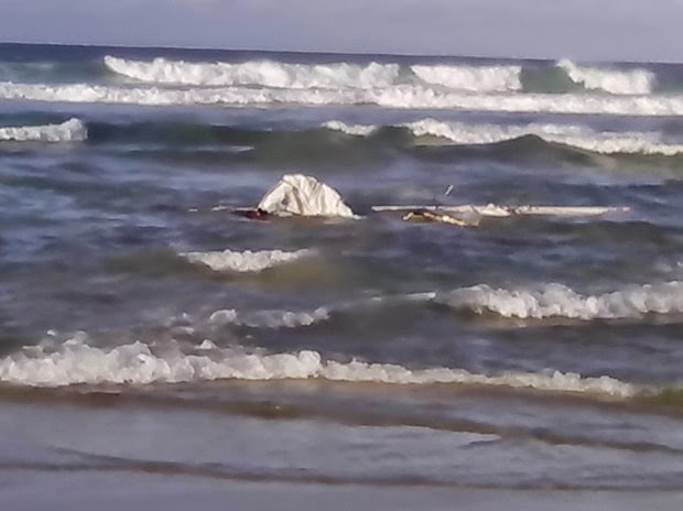
The remains of the 8.2 meter yacht INGRID62 which belonged to Darrel Hansen, from Mossel Bay.
At approximately 08h00 this morning, Tuesday the 6th of May, NSRI Oyster Bay volunteers were activated following reports of a yacht run aground in Oyster Bay.
Mark Mans, NSRI Oyster Bay station commander, said: “Our duty crew responded to find solo sailor, 62 year old Darrel Hansen, from Mossel Bay, safe on the beach in the care of bystanders who had happened upon the man lying on sand dunes and attempting to reach a place where he could raise the alarm early this morning.
“During a storm in the night no one had noticed the yacht run aground which happened some half a kilometre away from the edge of the Oyster Bay housing line.
“Mr Hansen, sailing on his 8.2 meter yacht INGRID, from Mossel Bay to Port Elizabeth, had run aground during the night after attempting to sail his yacht into the shelter of Oyster Bay to escape rough weather but a wave had capsized his boat (estimated to have happened at around 9 p.m. last night) and the boat was washed ashore and broke up on rocks approximately half a kilometre away from the edge of the housing line in Oyster Bay.
“Mr Hansen lost his prosthetic leg during the ordeal but he managed to get to shore and he had crawled towards houses to as far as sand dunes where he was found by early morning walkers lying on a sand dune exhausted, and they raised the alarm.
“It appears that Mr Hansen lost everything during the incident. Waves had ripped his clothes from his body and he was found with nothing except the shattered yacht and debris lying amongst rocks nearby.
“His attempt to get to shore was hampered by him losing his prosthetic leg during the incident.
“Our NSRI Oyster Bay volunteers have taken Mr Hansen into their our care and have clothed him and fed him and arrangements made to get hold of his wife in Mossel Bay.
“Most of his prosthetic leg was found in amongst the debris but unfortunately a certain piece of the prosthetic leg that makes it usable was not found and the prosthesis will have to be repaired before it can be used.
“Only minimal equipment has been able to be recovered from the yacht which is mostly shattered in pieces across the shoreline.
“What could be salvaged will be stored at our Sea Rescue base until it can be returned home.
“Our NSRI Oyster Bay volunteers will shelter Mr Hansen this morning and as soon as someone from Mossel Bay can be arranged to come and collect him, when that happens, an NSRI Oyster Bay volunteer will drive Mr Hansen part of the way towards Mossel Bay to rendezvous with the people coming to collect him.”
Darrel Hansen after his ordeal.
The remains of the 8.2 meter yacht INGRID62 in the surf at Oyster Bay.
- NSRI
Labels:
NSRI,
Sea Rescue
Sunday, 13 April 2014
SEA RESCUE – Wilderness – Saturday, 12th April, 2014. Child drowns in lagoon:
Hennie Niehaus, NSRI Wilderness station commander,
said:
"At 17h49, Saturday, 12th April, NSRI Wilderness volunteer sea rescue
duty crew were activated following reports of an 8 year old local male missing
at the lagoon on Touws River (adjacent to the N2 Freeway),
Wilderness.
"Our NSRI volunteer sea rescue duty crew and the SA Police Services
responded to the scene where as NSRI volunteers arrived a female bystander had
located and was in the process of recovering the body of the child from the
water.
“Our NSRI medics commenced Cardio Pulmonary Resuscitation
(CPR) on the child who was found to be breathless and pulseless from suspected
drowning and the WC Government Health EMS were summoned to the scene and
advanced life support CPR continued in the ambulance en route to hospital where
extensive CPR efforts continued in hospital but sadly after all efforts to
resuscitate the child were exhausted he was declared deceased by
doctors.
"it was established that the 8 year old had disappeared under water
while swimming with friends.
“While the alarm was raised a search had commenced along
the banks of the lagoon. A female bystander located and recovered the body of
the child from the lagoon after she happened to come across the body of the
child floating semi submerged in the water (as Sea Rescue were arriving on the
scene).
“Police have opened an inquest docket."
“Sincerest Condolences are expressed to the family of the
deceased child."
-ENDS-
Released by:
Craig Lambinon
SEA RESCUE
COMMUNICATIONS
Labels:
Maritime Matters,
Sea Rescue
Sunday, 23 March 2014
SEA RESCUE – Plettenberg Bay and Still Bay – Friday, 21st March, and Saturday, 22nd March, 2014. Swimmer rescued - Plettenberg Bay and NSRI assist at motor vehicle accident - Still Bay:
PLETTENBERG BAY:
At 13h35, Friday, 21st March, NSRI Plettenberg Bay volunteer sea rescue duty crew were activated following reports of a swimmer being swept out to sea by rip currents at Natures Valley.
NSRI Plettenberg Bay volunteer sea rescue duty crew launched the sea rescue craft RAY FARNHAM RESCUER and responded.
On arrival on-scene a 25 year old East London man was found approximately 1.2 km off-shore caught in rip currents and he was rescued onto the Sea Rescue craft and brought to shore where he was reunited with family and medically checked and found to be not injured and he required no further assistance.
STILL BAY: At 13h30, Saturday, 22nd March, NSRI Still Bay volunteer sea rescue duty crew responded to 8 kilometres outside of town, on the R305, at the request of the Emergency Services to assist Emergency Services at a severe motor vehicle accident involving two local men on a motorcycle and a motor vehicle believed to have been involved in a head on collision.
On arrival on-scene two NSRI Still Bay medics assisted the WC Government Health EMS paramedics treating who were the two men that had been on the motorcycle suffering multiple critical injuries.
NSRI Still Bay volunteers assisted Police and the Traffic Services with traffic control on the blind bend in the road where the accident had occurred. The two adult men, who were on the motorcycle, have been transported to hospital by EMS ambulance in critical conditions suffering severe multiple injuries and both men, who have since been transferred to a hospital in George, one of whom is on artificial life support, remain in critical conditions.
The single male occupant of the motor vehicle was not injured. Police are investigating the accident.
-ENDS-
Released by:
Craig Lambinon
SEA RESCUE COMMUNICATIONS
NSRI Plettenberg Bay volunteer sea rescue duty crew launched the sea rescue craft RAY FARNHAM RESCUER and responded.
On arrival on-scene a 25 year old East London man was found approximately 1.2 km off-shore caught in rip currents and he was rescued onto the Sea Rescue craft and brought to shore where he was reunited with family and medically checked and found to be not injured and he required no further assistance.
STILL BAY: At 13h30, Saturday, 22nd March, NSRI Still Bay volunteer sea rescue duty crew responded to 8 kilometres outside of town, on the R305, at the request of the Emergency Services to assist Emergency Services at a severe motor vehicle accident involving two local men on a motorcycle and a motor vehicle believed to have been involved in a head on collision.
On arrival on-scene two NSRI Still Bay medics assisted the WC Government Health EMS paramedics treating who were the two men that had been on the motorcycle suffering multiple critical injuries.
NSRI Still Bay volunteers assisted Police and the Traffic Services with traffic control on the blind bend in the road where the accident had occurred. The two adult men, who were on the motorcycle, have been transported to hospital by EMS ambulance in critical conditions suffering severe multiple injuries and both men, who have since been transferred to a hospital in George, one of whom is on artificial life support, remain in critical conditions.
The single male occupant of the motor vehicle was not injured. Police are investigating the accident.
-ENDS-
Released by:
Craig Lambinon
SEA RESCUE COMMUNICATIONS
Labels:
NSRI,
Sea Rescue
Subscribe to:
Posts (Atom)