Showing posts with label Severe Weather. Show all posts

Wednesday, 25 March 2015

Opvolg/Fotos: #Meiringspoort weer oop vir verkeer

OUDTSHOORN NUUS - Meiringspoort is weer oop vir verkeer.
 
Die poort is gesluit nadat erge reën die rivier in vloed laat afkom het.
 
'n Greyhound-bus en verskeie ander voertuie het in die poort vasgesit.


Article and images: Oudtshoorn Courant (Click on images for larger view.)

Tuesday, 24 March 2015

Greyhound bus vasgekeer in Meiringspoort


08:17 (GMT+2), Tue, 24 March 2015  - OUDTSHOORN NUUS - Die Greyhound-bus waarop 18 mense laasnag in Meiringspoort buite Oudtshoorn vasgekeer was, sal vanoggend deur 'n insleepdiens verwyder word.

Die insittendes van die bus het deur vensters van die boonste verdieping geklim en op die krans geskuil toe die watervlak vinnig gestyg het.

Hulle kon teen middernag, nadat die water weer gesak het, terugklim in die bus waar hulle op nooddienste gewag het.

Twee polisielede en bestuurders van ten minste drie ander swaar voertuie was ook vasgekeer.

Die twee insittendes van 'n groen Golf, waaroor mense laasnag navraag gedoen het, is ook veilig. Dit blyk dat die motor naby die plek waar die bus en ander swaar voertuie vasgekeer is van die pad afgespoel is. Die insittendes is deur nooddienstewerkers gered. Een van die insittendes is in die hospitaal.

Volgens verkeersowerhede sal die poort nog 'n geruime tyd gesluit wees


22:48 (GMT+2), Mon, 23 March 2015 - OUDTSHOORN NUUS - Die Oudtshoorn Courant het pas verneem die bus-passasiers kon van die rotse afkom en terugklim in die bus nadat die watervlak heelwat gesak het.

Die nooddienste in De Rust het pas 'n vergadering gehou en besluit dis nog nie veilig om van De Rust se kant by die bus uit te kom nie.

Op hierdie stadium lyk dit asof Metro-nooddienste van Beaufort-Wes se kant af 'n beter kans het om by die bus uit te kom.

Die nooddienste het bevestig dat hulle vanaand heel aand op die toneel gaan bly totdat dit veilig is om die mense van die bus af te haal.

Meiringspoort sal beslis die res van die nag en waarskynlik heel dag môre gesluit wees.
21:53 (GMT+2), Mon, 23 March 2015 - OUDTSHOORN NUUS - Die Oudtshoorn Courant het onlangs sowat 1km vanaf De Rust saam met nooddienste tot by die eerste brug in Meiringspoort gery.

Die vlak van die rivier is sowat 'n meter bo oor die brug en ongeveer 35m breed.

Dit lyk asof die vlak die afgelope uur effens gesak het, maar nooddienswerkers kan steeds nie deur die drif gaan om by die vasgekeerde bus uit te kom nie.
Daar is vasgestel dat die bus by die laaste drif aan die Klaarstroom-kant van Meirngspoort vas.
Die mense op die bus het laat weet hulle kan noodligte sien wat van Beaufort-Wes se kant af na hulle kom, maar dis nog nie duidelik of daardie nooddienste by hulle kan uitkom nie.
Dis onduidelik of al 18 passasiers uit die bus is, maar volgens een van die Greyhound-personeel, wat via radio met nooddienswerkers in kontak is, het die watervlak gedaal en is almal veilig. 
21:13 (GMT+2), Mon, 23 March 2015 - OUDTSHOORN NUUS - Die Oudtshoorn Courant is op die oomblik op die toneel in Meiringspoort.

Die Grootrivier loop tans ongeveer 30m breed in volle vloed.

Daar is bevestig dat 9 van die 18 passasiers van die Greyhound-bus daarin geslaag het om op die bus se dak te klim en van die dak af tot op kranse. Hulle is buite gevaar maar is vasgekeer en nooddienswerkers kan nie by hulle uitkom nie. Die ander 9 passasiers is steeds in die bus.
Vier polisiemanne is ook vasgekeer.

Dit reën steeds.
20:47 (GMT+2), Mon, 23 March 2015 
Oudtshoorn - Nooddienste het pas by Meiringspoort aangekom nadat hulle in kennis gestel is dat 'n passasiersbus en verskeie ander voertuie in die poort vasgekeer is nadat die rivier in vloed afgekom het.
Die bus is in 'n drif vasgekeer en passasiers is besig om op die dak te klim. Nooddienswerkers sukkel om by die bus uit te kom as gevolg van die hoë watervlak.
Van die ander voertuie wat vasgekeer is, is 'n swaar vragmotor en 'n polisievoertuig.
'n Vragmotor het ook in die rivier omgeslaan. Die bestuurder is nie beseer nie.
Dit het intussen weer begin reën.
Die pas is gesluit en sal die hele nag gesluit bly. Motoriste moet Willowmore om ry vanaf De Rust.

- Oudtshoorn Courant

Thursday, 19 March 2015

Lightning kills 6 construction workers in the Free State

Bloemfontein - Six construction workers are dead after being struck by lightning on the N8 outside Botshabelo near Bloemfontein on Wednesday, said paramedics.

Five others were injured, said ER24 spokesman Chitra Bodasing.
The men, between the ages of 20 and 40, took refuge under a structure when it began to rain and the lightning struck.

“ER24 paramedics and other services arrived on scene and found the patients lying in and around the structure,” said Bodasing.

The six were declared dead on the scene while the five sustained minor injuries.
They were treated on scene before being transported to a local hospital for further treatment.

On Tuesday, a Grade 11 pupil from Hoër Tegniese Skool (HTS) died after also being struck by lightning.

Francois Clarence, who was a first team hockey player was reportedly playing against a team from Potchefstroom when the storm struck without warning on Tuesday afternoon, a Sapa correspondent reported.

“The teachers told the players to run to the school cafeteria, which was 200 metres away. While he was running across the rugby field, Francois was struck by lightning,” said Emalahleni police spokesman Captain Eddie Hall.

“From the reports it looks like he was hit directly by the lightning, as his clothes were burnt. The lightning didn't strike the ground first.”

Paramedics were immediately called to the scene and tried to resuscitate Clarence, whose heart had stopped beating.

They got a faint pulse and he was rushed to intensive care at Life Cosmos Hospital.

Family, fellow pupils, and community members held a prayer session at the hospital but he died late on Tuesday night.

Sapa + IOL

Wednesday, 28 January 2015

Nor'easter Pounds #NewEngland #blizzard #snowfall #snowstorm


The U.S. National Weather Service called it a “a crippling and historic winter blizzard.” In late January 2015, transportation systems from Trenton to Portland were shut down, and more than 35 million people hunkered down for extreme snowfall and biting winds. For those in New England, it turned out to be a monstrous storm. For the Mid-Atlantic region, not so much.
Vast swaths of Massachusetts, Connecticut, Rhode Island, New Hampshire, Maine, and Long Island (NY) were blanketed with 15 to 25 inches (40 to 60 centimeters) of snow as of midday on January 27, 2015, and snow was expected to continue into January 28. Sustained winds reached gale force, with hurricane-force gusts along the coastlines. Storm surges sent ice and water into the streets of Scituate and Nantucket, Massachusetts. Many New England towns, including the city of Boston, were expected to approach all-time snowfall records.
The Visible Infrared Imaging Radiometer Suite on the Suomi NPP satellite acquired these nighttime images at 1:45 am US eastern standard time (06:45 Universal Time) on January 27, 2015. The top image, lit by moonlight and city lights, shows a nor'easter off the coast of the East Coast of the United States. City lights are blurred somewhat by the cloud cover. The second image shows the same scene in longwave infrared radiation, with brighter shades representing the colder temperatures of snow-producing clouds.
The map below shows the same storm as observed around the same time by microwave imagers on Global Precipitation Mission (GPM) satellite and the Advanced Microwave Scanning Radiometer 2 (AMSR2) onboard the GCOM-W satellite. GPM captured the right and left edges of the storm, while AMSR2 captured the middle section of data. These microwave imagers see through the tops of clouds to observe how much and where precipitation occurs. Note that because of the microwave channels used in this image, details of the storm are easier to see over the ocean.


State and city governments in Massachusetts, New York, Connecticut, Rhode Island, and New Jersey took the unusual step of banning travel on all major roadways during the storm. Most of those bans were lifted by midday on January 27, though Massachusetts and Rhode Island extended it later. Thousands of airline flights were canceled, and train service was halted in the Northeast Corridor.
While the forecasts were quite good for New England, the New York-to-Delaware corridor saw far less snow because the storm tracked farther offshore than predicted. Commenting on how the media and the meteorological community handled the event, Marshall Shepherd of the University of Georgia noted:
The models were always more certain that Long Island, Boston, and other parts of the Northeast would be the bullseye. And they currently are...The models were always iffy on the NY/NJ region...There is more risk and nuance in weather forecasts than the public is interested in consuming, so it is a challenge to craft a message that gets attention and is not hype, yet has actionable information. We must continue to have the discussion about how to communicate uncertainty and risk effectively...A historic storm did happen, it just didn't hit NYC hard.
  1. References and Related Reading

  2. Capital Weather Gang, via The Washington Post (2015, January 27) Updates: 21.5 inches of snow in Boston, 30 in eastern Mass. Accessed January 27, 2015.
  3. Capital Weather Gang, via The Washington Post (2015, January 27) Why the snow forecast for New York City was so bad, and what should be done. Accessed January 27, 2015.
  4. NOAA National Center for Environmental Prediction (2015, January 27) Storm Summary Message. Accessed January 27, 2015.
  5. NWS Chat, National Weather Service (2015, January 27) Area Forecast Discussion. Accessed January 27, 2015.
  6. National Weather Service (2015, January 27) Public Information Statement. Accessed January 27, 2015.
  7. From the Mind of J.Marsh WxGeeks Edition, via Weather Underground (2015, January 27) Fallout from the Blizzard: Our Take. Accessed January 27, 2015.
NASA Earth Observatory image by Jesse Allen, using VIIRS data from the Suomi National Polar-orbiting Partnership. Suomi NPP is the result of a partnership between NASA, the National Oceanic and Atmospheric Administration, and the Department of Defense. Caption by Michael Carlowicz.
Instrument(s): 
Suomi NPP - VIIRS - NASA

Monday, 26 January 2015

#SAWeather and #Disaster #Observations South Africa : 26 January 2015 04h00 SAST - MSBWX


SAWS SEVERE WEATHER ALERTS: 
 
WARNINGS: ------Nil 

WATCHES: ------Nil  

SPECIAL WEATHER ADVISORIES: Hot and humid weather will result in extremely uncomfortable conditions in places over the eastern KwaZulu-Natal and the lowveld of Limpopo.  

MSBWX National Severe Weather Observations: Observations yesterday: Intense and dangerous lightning, strong wind, hail, heavy rain and flooding. (Gauteng,  Eastern Cape, Free State, Kwazulu Natal and Mpumalanga)


Images: Twitter and as indicated in each image.

MSBWX General Weather Observations:  Warm to very hot conditions expected today over parts of SA. Thunderstorms and rain showers can be expected in parts of  Gauteng, Mpumalanga, North West, Limpopo, Northern Cape, Western Cape, Eastern Cape, Kwazulu Natal and Free State. 

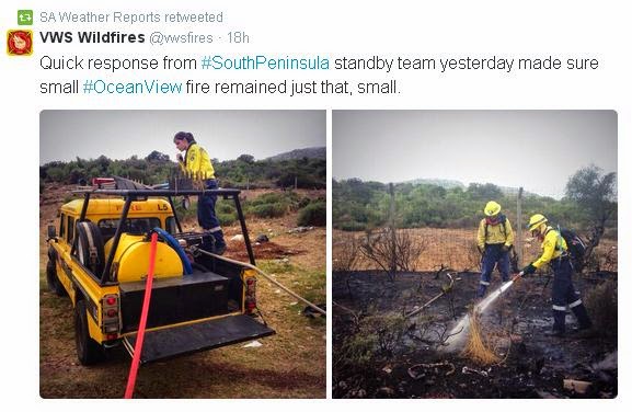
MSBWX National Disaster Observations: Fires: Fire fighting teams again battled several fires in the Western Cape.  A large fire also raged in Stikland at the SAB premises.


NSRI National Warnings and News


21 Rescued at Dappat se Gat:   At 16h25, Sunday, 25th January, NSRI Gordon’s Bay duty crew were activated by the Transnet National Ports Authority (TNPA) following reports of people trapped by the incoming tide on a cove cut off by high tide at Dappat Se Gat, Koegelbaai, between Gordons Bay and Pringle Bay. It appears that groups of people had gone onto the popular sightseeing rocky outcrop during the current new moon Spring low tide not realising that high tide would cut them off from mainland and that the Spring tides high tide risked engulfing the rocky outcrop. Some of the people, realising their predicament, called for help and on arrival on-scene NSRI rescuers confirmed that the risk of getting rescue swimmers onto the cove was too great in the incoming tide. Rescue craft would not be able to get close enough to extricate the group of people from the sea side without incredible risk. At that stage it was estimated that at least 16 people were trapped and NSRI Simonstown, WC Government Health EMS rescue squad and the Red Cross AMS Skymed rescue helicopter were activated. NSRI Simonstown dispatched the rescue craft SPIRIT OF SAFMARINE III and the Skymed rescue helicopter responded to join NSRI Gordons Bay rescue swimmers that were on the scene on the shore and NSRI Gordons Bay rescue craft SPIRIT OF SURFSKI and INGE (a Swedish rescue runner) that were standing by on the scene. Cape Town Fire and Rescue Services and the SA Police Services were also dispatched. The decision was taken to hoist as many people as possible in relays using the Skymed rescue helicopter before the high tide engulfed the cove. NSRI rescue swimmers and the rescue craft stood by to retrieve anyone who got swept into the ocean. It was then determined that a total of 20 people : 2 boys aged 7 and 8 years old, 10 adult men and 8 adult women. It appears that they were not aware of the new moon Spring tide and that the sea would cut off the popular rocky outcrop at high tide and risk being engulfed under water at high tide. (During normal tide these rocks are easily accessible even at high tide). A WC Government Health EMS rescue diver, Jason Higgins, was hoisted down from the Skymed rescue helicopter and supervised the successful rescue of all 20 people who were hoisted off by the rescue helicopter using a “short haul rescue technique”. Jason found all people safe. It appears that some of the people were unaware of the danger they were in but Jason called all of the people together and explained the situation and that they would all be extricated. As the tide rose, eventually everyone was huddled to a corner of the rocky outcrop and in relays of 5 persons at a time the “casualties” were kitted into harnesses by Jason and static line hoisted to mainland where additional rescuers were on hand to receive them. The rescue helicopter had reached its fuel limit when the last group were hoisted off and the helicopter was forced to return to base having successfully completed the rescue operation. It then emerged that one man was still trapped but he had not been in a position to indicate his entrapment due to the high seas and he was well hidden from view. Rescuers were only made aware of him after his wife indicated where the man had last been seen and that he remained outstanding. They are from Cape Town. A rescue team from Wilderness Search and Rescue (WSAR) was deployed from the land side and they rescued the 45 year old man after negotiating steep cliffs to reach the man. The rescued people were a group of people (16 people in total) from Kuils River aged between 28 and 34 and including the 7 year old and the 8 year old boy. From Pietermaritzburg, an elderly husband and wife. A Johannesburg adult man and the adult couple from Cape Town. In total 21 persons were rescued. When rescue teams were finally leaving the scene most of the rocks were engulfed by water. Even if the 21 people had huddled to the highest point it may only have been at around midnight tonight before they would have had any chance at low tide to get back to mainland and, dressed in normal day beach wear, it is predicted that most would have succumbed to hypothermia by then. A strong possibility that not all of the 21 people would have been able to remain on the cove in the incoming tide and at high tide and it is strongly suspected that a number of the people may have been swept into the sea. The rescue effort by the Red Cross AMS Skymed rescue helicopter team, WSAR, NSRI and the emergency services involved in this operation are commended for averting a mass casualty disaster today. - NSRI

All images: Twitter and as indicated in the images.

-MSBWX SAWXREP + SAWS

Sunday, 25 January 2015

#FunnelCloud Observed in the #Mosselbay area (10 December 2014)


Image: Frik (Lone Runner) (Click on image for larger view.)

Rare and amazing image: Although a bit late to report this image is still worthy for record purposes.  The image depict a funnel cloud in the Mossel Bay area as observed and photographed by Frik.  Thanks Frik for sharing this rare image.

I have been living in Mossel Bay for more than 20 years and this is the first funnel cloud reported in the Mossel Bay area.  A few years ago a water spout was reported at Brenton on Sea in the Knysna area.  And who say's that  Mossel Bay has the second best climate in the world?  One never knows what Mothern Nature can throw at you.  Always keep and eye on the weather and keep your camera close-by!

Wednesday, 21 January 2015

The Once-Powerful #Tropical #Cyclone #Bansi Stirred Up Ocean Sediment

On Jan. 19, NASA's Aqua satellite spotted sediment stirred up by Tropical Cyclone Bansi around the Cargados Carajos Shoals, Indian Ocean.
Image Credit: 
NASA Goddard MODIS Rapid Response Team

Tropical Cyclone Bansi reached a Category 4 status on the Saffir-Simpson Scale on January 15 and 16 as it moved through the Southern Indian Ocean. By January 19 as the storm was weakening over open ocean, NASA's Aqua satellite captured a picture of sediment stirred up from the storm around the Cargados Carajos Shoals.
On Jan. 15 at 0900 UTC (4 a.m. EST), Tropical Cyclone Bansi as a Category 4 hurricane on the Saffir-Simpson Scale with maximum sustained winds near 130 knots (149.6 mph/240.8 kph). At that time Bansi was centered about 451 nautical miles (519 miles/835 km) east of Port Louis, Mauritius.
On January 18 at 0900 UTC (4 a.m. EST) the time of the Joint Typhoon Warning Center's last bulletin on the system, Bansi's maximum sustained winds had dropped to 65 knots (74 mph/120.4 kph) and it was located 1,425 nautical miles (1,640 miles/2,639 km) southwest of Cocos Island. Later in the day, Bansi started extra-tropical transitioning and by January 19, it was a weaker extra-tropical cyclone moving over open waters of the Southern Indian Ocean.
On January 19 at 10:15 UTC (5:15 a.m. EST) when NASA's Aqua satellite passed over the Cargados Carajos Shoals, the Moderate Resolution Imaging Spectroradiometer or MODIS instrument aboard captured a visible image of the results of Bansi's powerful winds. The image showed sediment stirred up from the ocean bottom around the Shoals had colored the ocean waters around them.
According to Mauritiusattractions.com, Cargados Carajos Shoals is also known as Saint Brandon and consists of more than 50 islands, coral ridges and vast sand flats on an extended reef. It is located in the Southern Indian Ocean about 268 nautical miles (308 miles/496 km north east of Mauritius.
Rob Gutro
NASA's Goddard Space Flight Center

Saturday, 17 January 2015

#SAWeather and #Disaster #Observations South Africa : 17 January 2015 04h00 SAST - MSBWX

SAWS SEVERE WEATHER ALERTS: 
 
WARNINGS: -------Nil 

WATCHES: ----Nil 

SPECIAL WEATHER ADVISORIES: ----Nil 

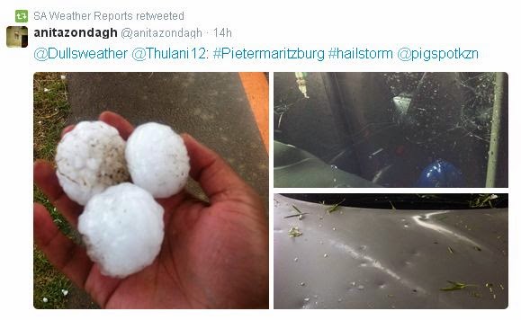
MSBWX National Severe Weather Observations:  What an interesting weather day yesterday.  It all started with a cold front meeting up with warm air that resulted in severe weather being experienced in areas of the country.  Provinces that bear the brunt were Gauteng, Western Cape, Eastern Cape and Kwazulu Natal. Large hail, intense lightning, heavy rain, gale force wind and flooding were reported. Provisional storm damage reports were received from Muizenberg, Port Elizabeth,  Uthungulu, Nkandla, Nxalala and Pietermatizburg. Several people were injured and houses and cars were damaged. Two people were struck by lightning in Kwazulu Natal.  Golf ball and egg size hail caused damage in Pietermaritzburg.  Images: Twitter and various observers as depicted in the images. (Click on images for larger view.)


Yesterday (16/1/2015) we experienced a classic weather phenomena were cold air met hot air, turns into severe weather and the above is the end result.  SAWXREP monitored temperatures throughout the day and it was obvious that severe weather were to be expected as temperatures dropped sharply as the front moved in over areas while hot and humid conditions were measured ahead of the cold front. Needless to say that all the other normal "ingredients" had to be present to form severe thunderstorms.


MSBWX General Weather Observations:  Cool, warm to hot conditions expected today over parts of SA. Thunderstorms and rain showers can be expected in parts of  Gauteng, Mpumalanga, Limpopo, North West and Free State. Isolated showers and rain can be expected in the Eastern Cape and Kwazulu Natal. 

MSBWX National Disaster Observations:  Several veld fires were again burning in parts of the Western Cape yesterday. 


NSRI National Warnings:------ Nil

- MSBWX + SAWXREP + SAWS