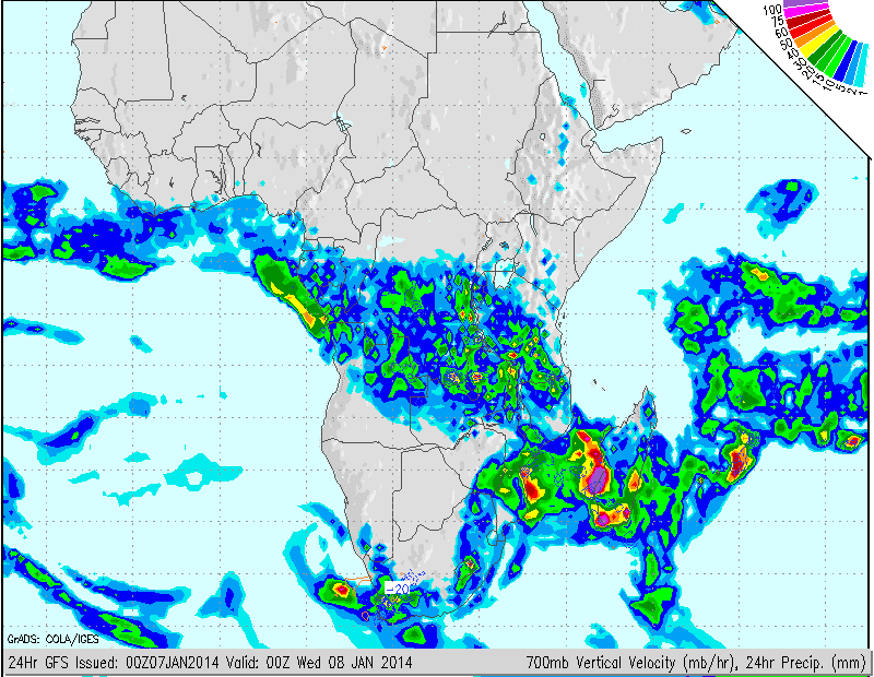
Images: NCEP (Click on image for larger view.)
The above forecast models reflect the possibility of heavy rain in areas of the Northern- Western- and Southern Cape for the next 48 hours. The Overberg and Southern Cape regions should especially be on high alert. The cut-off low is still very much alive and active and could dump heavy rain in these areas. The areas of concern is marked on the satellite image.
Image: SAT24 (Click on image for larger view.)
Reports have already been received of flooding in the Mossel Bay area where 28mm rain has fallen between 08h00 - 08h30 SAST in Heiderand. Flooding can also be expected in other areas of the Western Cape where heavy rain has fallen and river levels are steadily rising.
MSBWX request that members of the public be on high alert during the above period!!
Keep safe!!


