

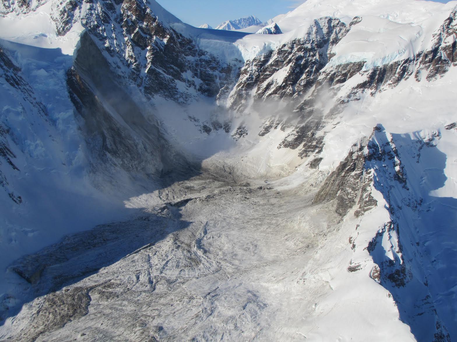
The Operational Land Imager on Landsat 8 acquired this image on February 23, 2014. The avalanche debris appears light brown compared to the snow-covered surroundings. The sediment slid in a southeasterly direction, stretching across 4.8 kilometers (2.9 miles) and mixing with ice and snow in the process. The slide was triggered by the collapse of a near-vertical mountain face at an elevation of 3,000 meters (10,000 feet), according to David Petley, a geologist at Durham University.
Columbia University scientists Göran Ekström and Colin Stark realized that a landslide may have occurred when they saw evidence in data collected by a global earthquake monitoring network. The earthquake sensors detect seismic waves—vibrations that radiate through Earth’s crust because of sudden movements of rock, ice, magma, or debris.
While earthquake sensors are tuned to detect intense, “short-period” seismic waves produced by sudden slips along faults, Ekström and Stark found evidence of the slide by analyzing “long-period” waves produced by landslides. However, Ekström and Stark could not pinpoint the exact location of the slide based on the seismic data alone; they could only say that it had occurred within a 25 square-kilometer (10 square-mile) area.
To pinpoint the location, the scientists needed observations from either aircraft or a satellite. In this case, the first confirmation of the slide came on February 22, 2014, when helicopter pilot Drake Olson flew over and photographed landslide debris at 58.542 degrees North and 137.01 West.
References
- Earth Observatory (2013, August 30) Hunting Landslides with Landsat. Accessed February 24, 2013.
- Ekström, G. & Stark, C. (2013, March 22) Simple Scaling of Catastrophic Landslide Dynamics. Science, 339 (6126), 1416-1419.
- Petley, D. (2013, March 22) Characterizing Giant Landslides. Science, 339 (6126), 1395-1396.
- Petley, D. (2014, February 20) Breaking news: a very large landslide in Alaska on Sunday. Accessed February 24, 2014.
- Petley, D. (2014, February 22) Mount La Perouse: Sunday’s rock avalanche in Alaska has been found. Accessed February 24, 2014.
- Petley, D. (2013, March 22) A very important new paper – detecting large landslides using seismic data. Accessed February 24, 2014.
NASA Earth Observatory image by Jesse Allen and Robert Simmon, using Landsat data from the U.S. Geological Survey. Caption by Adam Voiland.
- Instrument:
- Landsat 8 - OLI - NASA