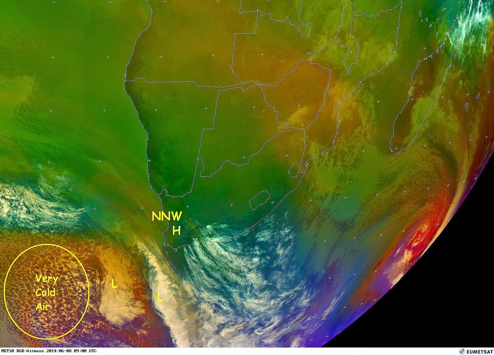
The latest satellite images clearly reflect the current position of the approaching cold front. Interesting to note is a secondary cold front just behind the first front. We currently have a strong NNW wind blowing in the Mossel Bay and George area. The strength is expected to pick up as the cold front moves closer to the main land. Predictions are still forecasting moderate to heavy rain, rough seas, gale force wind and very cold conditions with possible snow on the high mountains. It is difficult to predict an exact outcome of this event and therefor we need to monitor this weather system in real time mode. It appears that this cold front will not move over large parts of the interior of the country as was the case with the previous cold front. However the temperature are expected to stay on the low side. Let's see what this cold front has install for us in the next 48 hours..
Images: Eumetsat, NCEP and Weather Forecast (Click on image for larger view.)